27 May 2020

Mapping out testing sites

According to NJ.com, today's list of COVID-19 testing sites for New Jersey has 113 locations. They are not all open to the public. A couple are not very specific about the location. Some appear to be small and limited in ability while others are large and high volume.

The state relies on alternatives and private companies as part of that equation. Of the 113 listed testing sites, 58 are one of these retail locations:


Rite Aid drive-thru 13
CVS Pharmacy 11
MedExpress Urgent Care 7
Walmart 6
AFC Urgent Care 5
Immediate Care 4
PM Pediatrics 3
Patient First 2

UPDATE: CVS has announced that they are expanding to 45 drive-thru sites:
https://www.nj.com/news/2020/05/cvs-expands-drive-thru-coronavirus-testing-to-45-more-nj-locations.html (5/28)


The map below shows all 113 testing sites as points. The locations are generally more concentrated in urban areas than rural. The redlines are Voronoi polygons which calculate the areas closest to each site without regard to population or capability.


Looking closer, the list shows that the state's 4 largest cities only have a seven of the sites:
Newark:       3 sites   7.059 cases
Jersey City:  3 sites   6,709 cases
Paterson:      0 sites   7,007 cases
Elizabeth:    1 sites    5339 cases


That means those four municipalities represent about 9% of the state's residents and nearly 17% of the cases in New Jersey but have about 6% of the testing sites. The disparity is striking. Some of these are counting on larger sites in adjacent towns,  but those without cars might find this challenging. With limited information on capability, it is hard for us to know which sites contribute the most to New Jersey's burden. The map below shows distances from the sites (as the crow flies).


Even with a car, some areas are pretty distant. The map below shows areas within 20 minutes a of all sites, in yellow. Many of the underserved areas in North Jersey are from from other services too, so maybe they won't be surprised. But notice how much of the Jersey Shore is left without easy access - all of LBI is well over 20 minutes. The far ends of the island are over a 90 minute round trip to and from a testing center.


As the beaches reopen, New Jersey is going to need more testing near those active areas. Both for beachgoers and the many workers in LBI businesses.


I made these today with publicly available data and limited time while moving between other projects. But with more time and better data there is plenty more worth asking. What does the map look like if we remove few of the most selective sites (e.g., front line workers only)? Are the urban clusters of testing sites proportional to the populations in those areas? Do site capabilities change that any? How far do people without cars have to travel to access a walk-up or walk-in site? How does access compare with social vulnerability?


26 May 2020

Remembering Candace McKee Ashmun

One of New Jersey's most important voices for preservation has passed away. Candace McKee Ashmun, whose environmental leadership included service on the Pinelands Commission, ANJEC, the Great Swamp Advisory Committee, the Coalition for Affordable Housing and the Environment, and the NJ State Planning Commission, was 96 years old.

Sometimes called the Godmother of the NJ Pines, Ashmun's work as a founding member of the Pinelands Commission is permanently memorialized with the 4,000 acre NJCF Candace McKee Ashmun Preserve. But her impact was felt statewide.

I was struck by the way that all factions of the New Jersey environmental community respected her.  The Burlington County Times quoted Michelle Byers, “Within an environmental community that doesn’t always get along everyone respected Candy. She helped bring people together.”

19 May 2020

Wendell Berry

“If you don't know where you're from, you'll have a hard time saying where you're going.”

 ― Wendell Berry

Local rates of reported cases


The latest municipal map from the GeoHealth Lab shows recent activity down in Gloucester and Camden. But definitely keep watching AC as well. The earlier caveats still apply.

Fun with GIScience

The United States of Voronoi.

(If you can ever stop looking at that map, click on the link to his larger collection of maps.)

18 May 2020

Step 1: Rethink your resume

As things reopen, employers are going to trying emerge from this storm with exceptional people. How are they going to know that you could be one of them? The first place to tell them about it is a better resume. Harvard Business Review recommends a quick tune up to make sure it is accomplishing what you need.

When the resume gets transformed from an obligatory tool, to a rich opportunity to reach someone who is hiring, the conversation might begin.

14 May 2020

COVID-19 in NJ towns

New Jersey has 565 municipalities. Based on the reports I am seeing, there only 10 that still do not appear to be reporting a single case of coronavirus, yet. Altogether these 10 communities represent only about 3,000 people. Three of them, Pine Valley, Tavistock, and Walpack, each have fewer than 20 residents each. Pine Valley Borough CAMDEN Tavistock Borough CAMDEN Cape May Point Borough CAPE MAY Stone Harbor Borough CAPE MAY Shiloh Borough CUMBERLAND Stockton Borough HUNTERDON Harvey Cedars Borough OCEAN Mantoloking Borough OCEAN Elsinboro Township SALEM Walpack Township SUSSEX By April 7th the state had broken 500 municipalities reporting at least one case. On April 15th we had around 541 municipalities with cases. On April 27th we had 550. On May 10th Washington Township, Burlington County, reported a case leaving us with just 10 towns without reported cases.

07 May 2020

Getting better

The map of the changes in infection rates is definitely going in the right direction. When it finishes up, you will see blue flecks in Bergen County. That area which was an epicenter is now seeing declines in numbers.


Don't get too comfy, we still have a long ways to go. According to the New Jersey data dashboard, the Garden State still has over 131,000 cases. Based on the JHU COVID Dashboard, there are only about 8 countries (including the US) that have more cases.

This map is part of the ongoing effort at the GeoHealth Lab @ CRSSA to explore alternative ways to see and track patterns of the COVID spread across New Jersey.

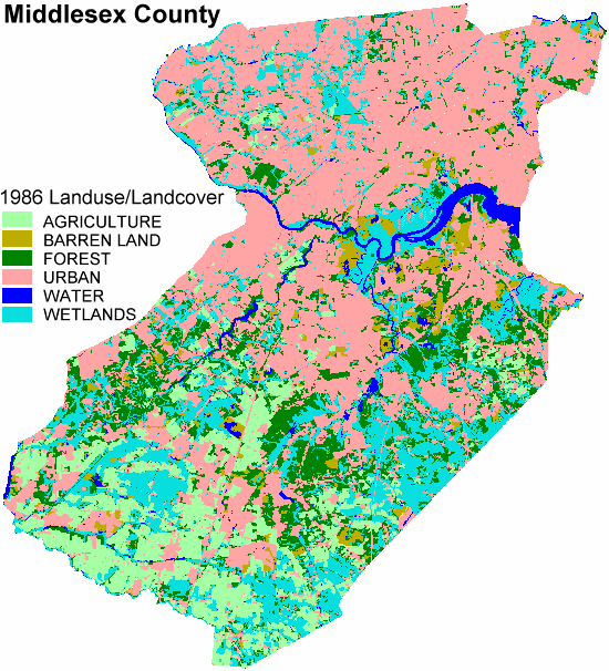
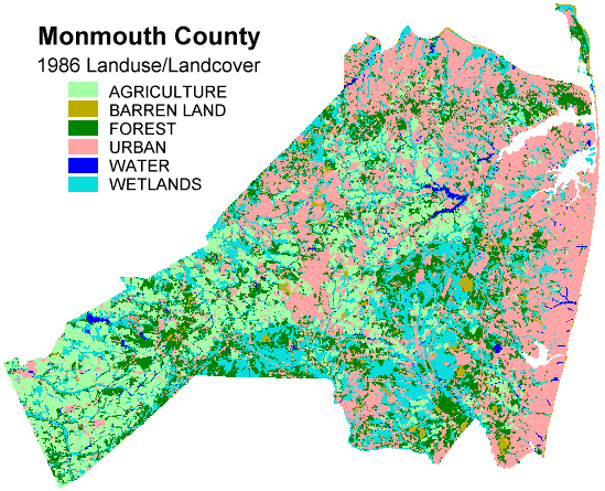
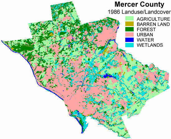
Land use maps


06 May 2020

Oyez

In class we mentioned Oyez as a helpful resource on Supreme Court cases about takings. Among the details it provides about cases are the recordings of the oral arguments, which are relatively short. For instance, you can listen to the attorneys for both sides of Dolan v. City of Tigard spar with the justices. They ask a few practical questions about the proposed bike path, but they also ask big questions about the implications of the precedent they might be about to set.


05 May 2020

Cinco de Mayo

Celebrate CInco de Mayo with some Mexican Landscape Architecture.

I finally made my first trip to Mexico City last year and was amazed.


Graceland Cemetery

One day after I mention it in class, the Chicago Tribune exhorts readers to visit Graceland Cemetery. After reminding us that the entire cemetery is an arboreal wonderland sprinkled with amazing architecture, including several Louis Sullivan monuments, the columnist drops an exclamation mark on it with a closing sales pitch for the Burnham burial site.
As powerful as the Sullivan-designed monuments are, my favorite place at Graceland is not a work of architecture, but a piece of environmental design — the island in the lake where the architect and urban planner Daniel Burnham and his family are buried. You reach the island by crossing a narrow wood footbridge. It leads to an irregularly-shaped boulder that marks the resting place of Burnham and his wife Margaret.
A canopy of trees offers a sense of shelter, while the water surrounding the island adds a dose of serenity. The lakefront that Burnham championed as a great public space is closed to the public, but here, at least, the visitor can honor the visionary who did so much to create it.

04 May 2020

Coronavirus by town

                             
Hospitalizations are down and the rate of cases is slowing, but the spatial spread continues. There are not many places left in New Jersey that are free from COVID-19. This map shows the rate, by municipality, by date (Cases/100,000).

If we isolate the 20 largest municipalities (by population), the May 1 reported rates still some variability. I've added population numbers (2010) for quick reference. Please remember that these are being made quickly during the outbreak and not with unlimited time to check and confirm. Hamilton Township is in Mercer County.

May 1 rates and 2010 population data


Reported Cases/100k 2010 Population Population Density
East Orange City 2277 64270 16395
Gloucester Twp 433 64634 2776
Old Bridge Twp 1142 65375 1690
Union City 4052 66455 51918
Middletown Twp 647 66522 1528
Passaic City 3238 69781 21604
Cherry Hill Twp 626 71045 2939
Brick Twp 1081 75072 2316
Camden City 1015 77344 7394
Clifton City 2568 84136 7361
Trenton City 1427 84913 10317
Hamilton Twp 928 88464 2199
Toms River Twp 1178 91239 1731
Lakewood Twp 1830 92843 3700
Woodbridge Twp 1438 99585 4148
Edison Twp 1290 99967 3263
Elizabeth City 3164 124969 8984
Paterson City 3416 146199 16824
Jersey City 2127 247597 15611
Newark City 1958 277140 10574