31 March 2014
New eminent domain twist
We've seen eminent domain used for hospitals and highways. More recently towns have used it controversially for sand dunes and hotel/conference centers. But, according a report in the Star-Ledger, the newest twist in New Jersey is that Irvington is considering using eminent domain as a tool to fight against foreclosures. Too far? Or better than some of the other uses of eminent domain?
30 March 2014
Cool Public Art
Here is a great video of a new public art installation by artist Janet Echelman and Google’s Aaron Koblin in Vancouver for the TED Meeting there.
25 March 2014
Daniel Winterbottom lecture
Rutgers University Landscape Architecture Common Lecture
March 26, 2014
4:00 – 5:15 p.m.
Cook/Douglass Lecture Hall, Room 110, Cook Campus
Daniel Winterbottom, RLA, FASLA, a landscape architect with a Bachelor of Fine Arts from Tufts University and a Master of Landscape Architecture from the Harvard Graduate School of Design and Professor of Landscape Architecture at the University of Washington. His firm, Winterbottom Design Inc., focuses their practice on healing/restorative gardens. His research interests include the landscape as a cultural expression, ecological urban design and the role of restorative/healing landscapes in the built environment. He has been published widely in Northwest Public Health, Places, the New York Times, Seattle Times, Seattle P.I., Landscape Architecture Magazine. He has authored “Wood in the Landscape” and has contributed to several books on sustainable design, community gardens, therapeutic landscapes and community service learning.
He has developed several programs including the participatory design design/build program in 1995 where with his students he works with communities to design and build projects that address the social and ecological concerns of the community. He has completed projects in Seattle, New York City, Bedford Hills New York, Mexico, Guatemala, Bosnia/Herzegovina and Croatia. In 2006 he developed the Healing Garden Certificate program at the University of Washington.
24 March 2014
Suitability anlysis readings
Here are the old handwritten Suitability Analysis notes from when Steve Strom used these techniques in his studio. This four page set of Suitability Analysis notes is online now as a PDF. His description of weighted analysis lacks a graphic, so I created a digital version of both some of his graphics and a new Weight and Rate graphic that should help you work through it all as you look ahead to our next exam: To be clear, each grid shows the very same piece of land but being rated for a different issue (soils, slope, vegetation). Presumably that is fairly objective. But each individual criterion is then weighted based on relative importance. In this case, Slope has rather subjectively been weighted as 5 times more important that Vegetation. If you click on my graphic it will enlarge and be more readable.
 To be clear, each grid shows the very same piece of land but being rated for a different issue (soils, slope, vegetation). Presumably that is fairly objective. But each individual criterion is then weighted based on relative importance. In this case, Slope has rather subjectively been weighted as 5 times more important that Vegetation. If you click on my graphic it will enlarge and be more readable.
23 March 2014
MAC-URISA PResentation opportunities
The Mid-Atlantic Chapter of URISA is holding a conference from October 22nd through the 24th (Wednesday through Friday) at the Revel in Atlantic City, NJ. They are still in need of abstract submissions to help us build the best program.
MAC-URISA is looking for presentations in these areas of study (very general):
Agriculture
Business
Cultural
Demographics
Education
Emergency Management
Environment
Finance
GPS
Historical
Human Services
LiDAR
Natural Resources
Parcel Mapping
Planning
Public Health
Public Safety
Surveying
Transportation
Utilities
Agriculture
Business
Cultural
Demographics
Education
Emergency Management
Environment
Finance
GPS
Historical
Human Services
LiDAR
Natural Resources
Parcel Mapping
Planning
Public Health
Public Safety
Surveying
Transportation
Utilities
Please see the following link for additional details: http://www.macurisa.org/2014/present
21 March 2014
Help find the missing 777
Instead of watching the 24 hour news channels repeat speculation, you could participate in the search for the Malaysia Airlines Flight 370. Digital Globe has created a crowdsourcing web interface, called Tomnod, to help sift through massive amounts of satellite imagery. The interface works very smooth, giving viewers one small tile at a time but allowing them to build a larger image providing a macroscopic view of what they have already seen. The app keeps "score" by tracking how many tiles you've checked, how many markers you have dropped on potential oils slicks or debris, and how many other crowdsourcers have marked the same spots.
Like some other successful VGI applications, this has appeal on multiple levels. It feels like a humanitarian offering, helping with a massive problem that would have felt largely beyond the ability of the individual. It does feel a little like a game, both in its ultimate goal (find the plane) but also in creating an ongoing sense of progress with the counters for tiles and markers. Even though it lacks a forum or conversation area, it gives participants a way to connect (symbolically) with contributors with similar motivation, plugging them into a virtual global community.
And like other disaster-related VGI applications, it is something that can be done cheaply and quickly. Mobilizing GIS volunteers is more expensive and time consuming, although it clearly accomplishes something very different.
18 March 2014
Roy H. DeBoer
Roy H. DeBoer, FASLA, CLA # 00001
Professor Emeritus of Landscape Architecture
May 7, 1933 - March 17, 2014
Feel free to post memories in the comments section.
17 March 2014
Public transit trend
DIRT summarizes a report showing that public transit use is reaching the highest levels in over 50 years. NextCity details some notable oddities and contradictions.
16 March 2014
NCAA brackets
Places and Space readers are invited to post their NCAA picks on the ESPN group, FoD - Friends of Dave v17. Good luck.
Blue Acres home demolished
"It's one down, 1,299 to go." NJ Spotlight reports that the first of the Sandy-devastated homes purchased under the Blue Acres has been demolished. This is a small but significant step towards getting residents out of the most floodprone areas.
Photo note: This is not the house in the story, but another victim of Sandy (and Sandy contractors).
Photo note: This is not the house in the story, but another victim of Sandy (and Sandy contractors).
14 March 2014
13 March 2014
Networking
Students graduating this spring are asking me how to meet professionals. My advice usually involves a time machine, because you should start meeting them around your sophomore year, not in your senior year.
Where ever you are in your studies or professional development, you might check out these upcoming events:
1) FREE - TOMORROW The NJ Geospatial Forum meets this Friday, March 14th, at 10 a.m. The meeting will be held in the ITC Room at OIT, 300 Riverview Plaza, Trenton, NJ 08611. Our speaker is Steve Welebny from Keystone Aerial Surveys Inc. He will speak about "Innovations in Image-Derived 3D Point Clouds" and will discuss the generation of dense and highly accurate colorized 3D point clouds from conventional digital imagery.
2) FREE Even if you do not enter the mapping contest you can attend and enjoy a really fun morning of GIS show and tell.
3) Finish Spring Break strong with this outstanding meeting that happens (this year) to be on the Busch Campus. The New Jersey Land Conservation Rally is one of the must attend gatherings of the year for those actively working to protect the landscapes of New Jersey. The incredible student rate of $25 makes this a particularly great investment in your future.
4) The Regional Plan Association has a slightly pricey meeting unless you are a student. how else are you going to spend a day at the Waldorf-Astoria for $125? And the meeting is a fabulous place to meet all sorts of professionals interested in planning.
When: Friday, April 25, 2014, 8:00 AM to 4:00 PM, followed by a reception
Where: The Waldorf-Astoria, New York, 301 Park Avenue
Register: https://rpaassembly2014.eventbrite.com
Full schedule: http://assembly.rpa.org
Where ever you are in your studies or professional development, you might check out these upcoming events:
1) FREE - TOMORROW The NJ Geospatial Forum meets this Friday, March 14th, at 10 a.m. The meeting will be held in the ITC Room at OIT, 300 Riverview Plaza, Trenton, NJ 08611. Our speaker is Steve Welebny from Keystone Aerial Surveys Inc. He will speak about "Innovations in Image-Derived 3D Point Clouds" and will discuss the generation of dense and highly accurate colorized 3D point clouds from conventional digital imagery.
2) FREE Even if you do not enter the mapping contest you can attend and enjoy a really fun morning of GIS show and tell.
The 27th Annual NJ DEP GIS Mapping Contest
April 10, 2014 – 10:00 am – 12:30 pm (contestants should arrive at 9:00 am)
NJDEP Building, Public Hearing Room, 401 E. State St., Trenton, NJ 08608
Theme: GIS – Keeping New Jersey Safe
3) Finish Spring Break strong with this outstanding meeting that happens (this year) to be on the Busch Campus. The New Jersey Land Conservation Rally is one of the must attend gatherings of the year for those actively working to protect the landscapes of New Jersey. The incredible student rate of $25 makes this a particularly great investment in your future.
4) The Regional Plan Association has a slightly pricey meeting unless you are a student. how else are you going to spend a day at the Waldorf-Astoria for $125? And the meeting is a fabulous place to meet all sorts of professionals interested in planning.
Full RPA Assembly program available!
Register by March 15 to save $50!
Where: The Waldorf-Astoria, New York, 301 Park Avenue
Register: https://rpaassembly2014.eventbrite.com
Full schedule: http://assembly.rpa.org
Featured Speakers
- The Honorable Earl Blumenauer, Congressman, U.S. House of Representatives
- Xavier de Souza Briggs, Vice President of Economic Opportunity & Assets, Ford Foundation
- The Honorable Bill Finch, Mayor, City of Bridgeport
- Polly Trottenberg, Commissioner, New York City Department of Transportation
- The Honorable John S. Wisniewski, Assemblyman, New Jersey State Legislature
- The Honorable Dawn Zimmer, Mayor, City of Hoboken
- CLICK HERE FOR MORE
12 March 2014
Stoss in Blake
If you visit Blake Hall this spring, make sure you visit the back hallway (past the new computer lab). We have a temporary exhibit of some design work (as seen on the cover of LAM) from Stoss Praxis (http://www.stoss.net/).
08 March 2014
Great view
TIME.com has posted a high resolution panoramic photo from the very top of the new Freedom Tower at the World Trade Center. The photo is so high resolution that you can explore it in detail and find lots of interesting architecture and landscape architecture in both New York and New Jersey. The zoom it permits really allows you to feel a bit like you have found something completely hidden in the larger photograph.
Here are a few that popped out as I explored include:
Can you find any interesting design work that I missed?
(Are you surprised to see Yankee Stadium to the left of the Empire State Building?)
Here are a few that popped out as I explored include:
- World Trade Center 9//11 Memorial
- The 9/11 Memorial at Liberty State Park
- Pier A in Hoboken
- Pier C in Hoboken
- a corner of Teardrop Park
- Nelson A. Rockefeller Park
- Brooklyn Bridge Park
- Fort Greene Park in Brooklyn
Can you find any interesting design work that I missed?
(Are you surprised to see Yankee Stadium to the left of the Empire State Building?)
07 March 2014
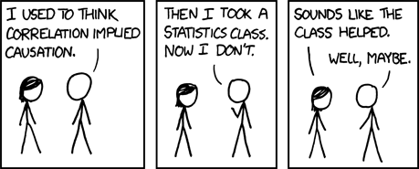
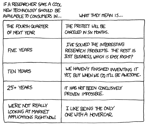
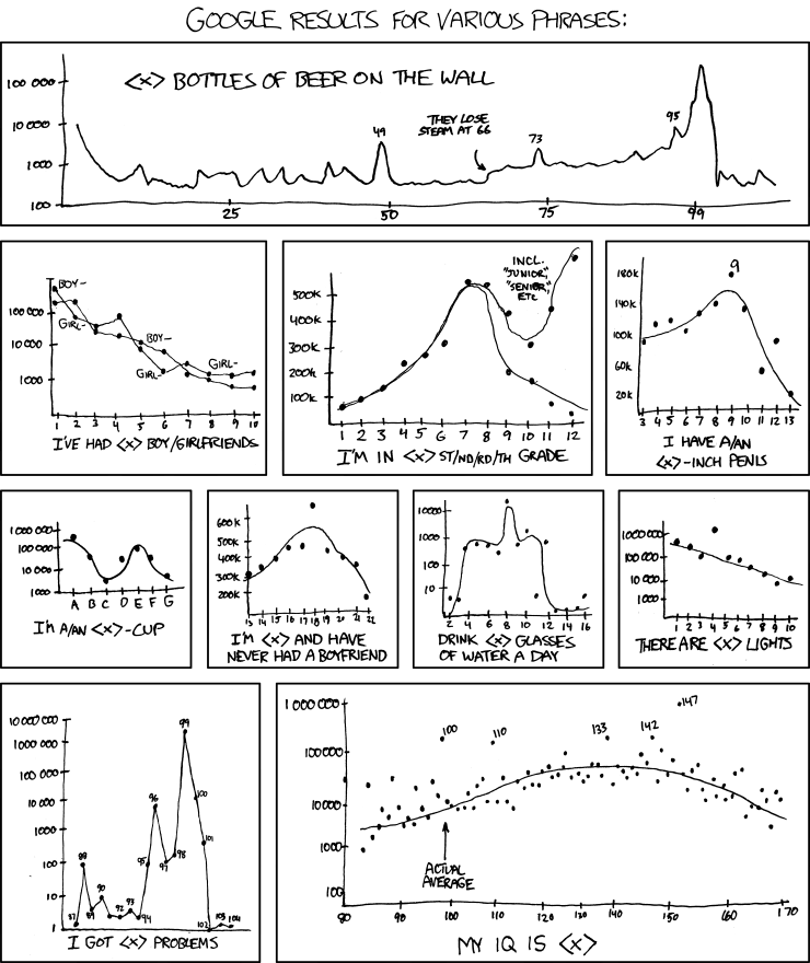
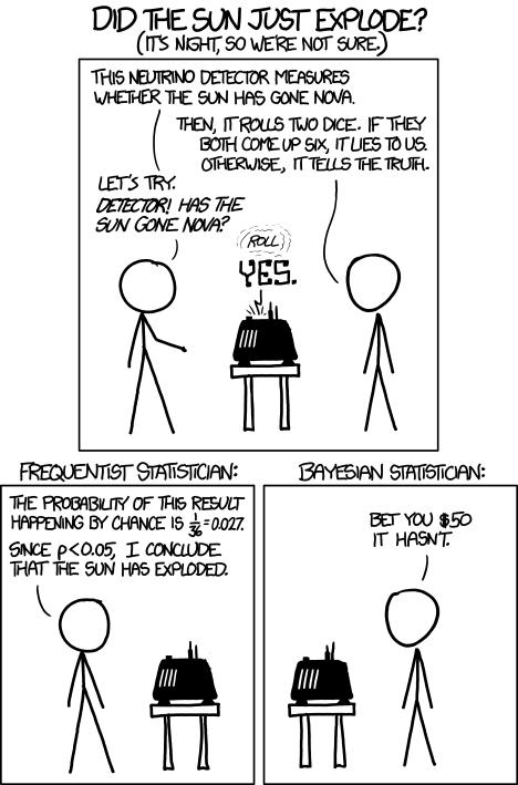
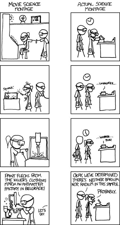
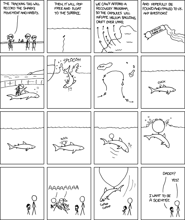
Friday funnies
If you don't get one of the comics, you could try to get an explanation at explain xkcd.
06 March 2014
Spring break reading
Spring break is coming, which means extra reading time. (Beach reading or not) Make the most of the time by grabbing something from Brent Toderian's list of 100 "Best" books on city-making. I wish it were tagged or listed years but the links will get you that information eventually.
You still have time to go to the library or order them online.
You still have time to go to the library or order them online.
Experimental design
I found a great resource to help with critical reading of research methods and findings.
Google's Driector of Research, Peter Norvig, has posted a useful list of red flags in experimental design reporting. It is pretty readable and covers many common mistakes.
Google's Driector of Research, Peter Norvig, has posted a useful list of red flags in experimental design reporting. It is pretty readable and covers many common mistakes.
05 March 2014
Sample topo maps
After talking about the free USGS topographic quads for NJ in class, I started getting more questions than usual about topo maps. So, I wanted to share some different scenes from around New Jersey that would be of interest. Just click and they'll expand.
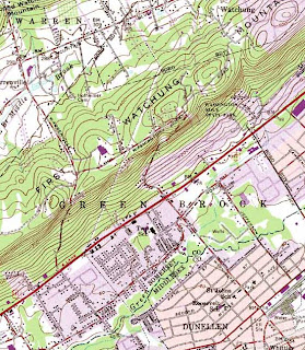
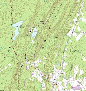
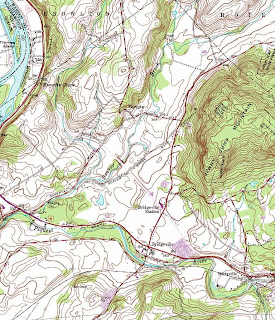
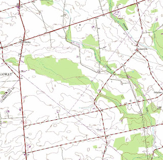
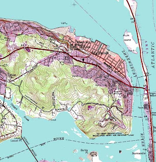
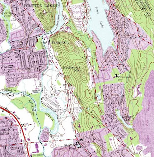
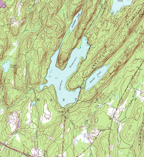
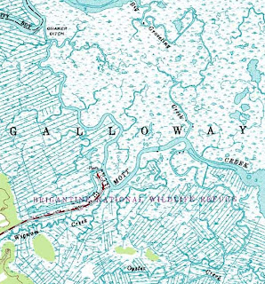
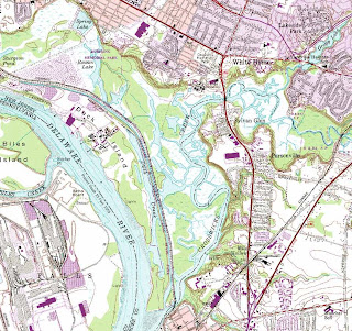 A special thanks goes out to Mike Siegel and the Rutgers Cartography Lab. This is a great resource for students and for pros.


 A special thanks goes out to Mike Siegel and the Rutgers Cartography Lab. This is a great resource for students and for pros.
04 March 2014
Slope maps
I have gotten a few questions this week about slope maps. Here are a few samples that might make it easier to think about what a slope map does and does not show.
Please note that both show how steep different areas are, but neither shows how high the hills are (elevation) or which way they face (aspect). That is why you cannot make a topo map from a slope map.
Please note that both show how steep different areas are, but neither shows how high the hills are (elevation) or which way they face (aspect). That is why you cannot make a topo map from a slope map.
03 March 2014
02 March 2014
Hydrographs
For our students who are trying to make sense of the hydrograph, this overly detailed explanation may shed some light on the workings of a this seemingly simple diagram. The BBC has a simpler tutorial for getting started. Both are more than we need, but that is how things go.
01 March 2014
The future is now
"We are being propelled into this new century with no plan, no control, no brakes."
– Bill Joy, Cofounder and Chief Scientist, Sun Microsystems
Subscribe to:
Comments (Atom)


