30 March 2013
Rich Haag at CELA 2013
Using some of his classic lines, like calling landscape architecture the art of the visual swindle, Rich Haag addressed the crowd at CELA 2013. The LAM blog gives a great summary.
28 March 2013
Where are the jobs?
The Bureau of Labor Statistics has mapped out where landscape architecture jobs are. In our region, both New York and Maryland jump out as hot spots. These statistics also include estimates of average salaries and industries where LA's tend to work.

By themselves the numbers are not as meaningful, but if you compare them with other professions on the BLS website, you can begin to really see some patterns.

By themselves the numbers are not as meaningful, but if you compare them with other professions on the BLS website, you can begin to really see some patterns.
27 March 2013
Ralph W. Voorhees Public Service Fellowships
Ralph W. Voorhees Public Service Fellowships
The Edward J. Bloustein School of Planning and Public Policy and the Voorhees Family have established the Ralph W. Voorhees Public Service Fellowships to honor Ralph W. Voorhees’ long commitment to community service. A 1948 graduate of Rutgers University, Mr. Voorhees was senior vice president for investments at Paine Weber and served as chairman of the boards of United Way of Central New Jersey, Family Counseling Services of Middlesex County, the Robert Wood Johnson University Hospital, and the New Brunswick Cultural Center. He has also been chairman of the board of the Rutgers University Foundation and served on the Rutgers University Foundation’s Board of Overseers. Mr. Voorhees has given generously to Rutgers and also supports Voorhees College, a historically black institution in South Carolina.
For the 2013-14 academic year, up to five (5) undergraduate students from the Rutgers New Brunswick campus, who are dedicated to community service, will be selected to receive Ralph Voorhees Public Service Fellowships. Fellows receive $5000 so they may participate in a credit-bearing community research project with Elijah’s Promise and the New Brunswick Community Food Alliance related to urban agriculture and community food security. Students selected for the fellowship will be required to register for a course during the Fall 2013 semester that will take place on Fridays from 9:50-12:50 at the Bloustein School. Students will do research in partnership with community organizations and will make a public presentation on their work at the end of the Fall semester, and will serve as mentors for future Fellows.
http://policy.rutgers.edu/rwv
24 March 2013
Time to plan ahead
The Fall 2013 Schedule of Classes goes live on March 25th.
Registration starts April 7th.
Get ready.
19 March 2013
After talking about Versailles in class last week, I thought we could celebrate Spring Break by pretending to visit the the city of lights. Well, not many lights in StreetView since they make their drives during daylight hours.These StreetView images are a repost of an old post.
The Lourve
View Larger Map
Place de la Concorde
View Larger Map
The amazingly elegant base of the Eiffel Tower
View Larger Map
Notre Dame
View Larger Map
Place des Vogues
View Larger Map
Palais de Versailles
View Larger Map
You can even drive into the garden and see The Grand Trianon
View Larger Map
Parque de la Vilette
View Larger Map
Euro Disney
View Larger Map
Par Andre Citroen
View Larger Map
View Larger Map
Finally, some lights in the infamous tunnels along the Seine right underneath the torch
View Larger Map
View Larger Map
18 March 2013
Forecast for April: Hot lectures
04.03.13
Martin Cox - Multiplicity
04.10.13
Thaisa Way - Post Industrial Landscapes: Richard Haag & Gas Works Park
04.11.13
Kate Orff - "Scape" Cekada Memorial Lecture_ Trayes Hall 6:30
04.17.13
Janike Kampevold Larsen - Beyond Nation: Challenges for Northern & Arctic Landscapes
04.24.13
Laura Starr - Wild for the City: Creating & Sustaining Urban Nature
check http://landarch.rutgers.edu/ for details
New tumblr feed: Interchanges
If you enjoyed the recent aerial imagery of Interstate highway interchanges, then you'll love our new tumblr page which will be almost nothing but interchange photos.
 If tumblr isn't your thing, you can just enjoy the photos from New Jersey, Kentucky, Louisiana, Kansas, Arizona, California, and more Kentucky in the blog archives.
15 March 2013
Great summer competition
Looking for something different to try this summer? How about a Korean design competition?
 Seoul Urban Design 2013 is going to be a high visibility competition. ASLA's The Dirt offers a quick overview.

14 March 2013
Is the High Line New York's Vasali Corridor?
Places and Spaces has written plenty about New York City's newest tourist landmark, the High Line. But a recent trip to the City got me thinking even more about how the new passageway above the city simply recalled another, much older elevated corridor.
In Florence, there is an elevated passageway hidden in plain sight called the Vasali Corridor. Not having been there, I have to experience it vicariously through other people's photos of the art-lined corridor.
Designed by its namesake, Giorgio Vasari, the corridor created a private passageway connecting many of Florence's landmarks: Palazzo Pitti, the Uffizi, Ponte Vecchio, and Palazzo Vecchio. This map of the Vasali Corridor shows that it really covers some ground.
Once you know it is there, you can see it plain as day in the picture on your pizza box.
Advice for students
Students, check out this list of Top Five Questions to Ask Yourself At Least Once A Week in College. Not all of them seem to fit perfectly for our students, but I particularly liked "Where is the nearest business that’d let me shadow for a day?" The overall point of the list is to get active and take steps to build your career now, instead of waiting until you graduate.
13 March 2013
Liveblog: Alistair McIntosh on Observation
Alistair McIntosh
Sasaki
Observation & Landscape Architecture
Studied at Edinburgh and UPenn
from Scotland
Cold and bleak place with an austere beauty
Previously at Hanna/Olin where he worked on J & J headquarters
1979
Became, in part, about the idea of landscape and architecture coalescing.

 (photos from Bria Holcomb's exhibit on New Brunswick changing landscape)
Self-Organizing Landscapes
example: Walden Woods

Indianapolis Waterfront Master Plan (Mapped) forms can be traced back to Aalto and 19th century harborworks and French engineering
Cincinnati Smale Waterfront Park (Mapped) Includes geothermal elements
terraces, adventure playground, earthworks
past work upstream was done by Zion and EDAW

Choose between two open space typologies:
Sasaki
Observation & Landscape Architecture
Studied at Edinburgh and UPenn
from Scotland
Cold and bleak place with an austere beauty
Previously at Hanna/Olin where he worked on J & J headquarters
1979
Became, in part, about the idea of landscape and architecture coalescing.
Self-Organizing Landscapes
example: Walden Woods
Indianapolis Waterfront Master Plan (Mapped) forms can be traced back to Aalto and 19th century harborworks and French engineering
Cincinnati Smale Waterfront Park (Mapped) Includes geothermal elements
terraces, adventure playground, earthworks
past work upstream was done by Zion and EDAW
Choose between two open space typologies:
- Bryant Park - open space trees on the side
- Harvard Yard - continuous grove of trees in the middle
Spatial Thinking Across the College Curriculum
The Final Report is out from the Specialist Meeting on Spatial Thinking Across the College Curriculum. The meeting, held in Santa Barbara, provided a great look at how spatial education could enhance learning in all corners of the academy. I was invited to present some thoughts about how design programs teach spatial thinking, and how different that is than many other fields.
In the end there were 4 overriding themes that came up throughout the meeting and deserve continued attention:
View Larger Map
In the end there were 4 overriding themes that came up throughout the meeting and deserve continued attention:
"1) claiming value in training spatial thinkers;While any meeting in Santa Barbara is pretty great, this cross-cutting meeting was incredibly stimulating. Take a peek at the report.
2) assessing the role of visualization in spatial thinking;
3) maintaining balance with technological changes; and
4) determining what can and should be done to advance spatial reasoning in undergraduate education."
View Larger Map
12 March 2013
Lecture: Observation & Landscape Architecture
Alistair McIntosh
Wednesday, March 13, 2013, 2013 @ 4:00 p.m.
Cook Douglass Lecture Hall - Rm 110
Observation and Landscape Architecture
Alistair
McIntosh, a former design principal at Sasaki Associates, will present
personal reflections on the design development of urban landscapes over
the last 35 years. “These reflections explain where, in my own
experience, design forms come from, how they are developed into built
landscapes and why this approach to landscape design (if not necessarily
the specific results) may help those starting in the profession to find
their own way within the discipline.”
Biography:
Alistair
McIntosh has over 35 years of experience in the practice and teaching
of landscape architecture. Prior to founding his own consultancy he was a
Design Principal in Sasaki Associates. He has also worked with:
Burck/McIntosh; Benjamin Thompson and Associates; Hanna /Olin; Joseph
Passonneau and David Skinner. His teaching and research at Harvard, MIT
and the University of Pennsylvania continue to inform and challenge the
ideas pursued in his practice.
Practice Philosophy:
The
office of Alistair McIntosh is a landscape consultancy that specializes
in the planning and design of public open spaces in cities. His
planning and design thinking is guided by the idea that urban open
spaces are environmentally situated stages for the conduct of
contemporary public and private social life. His design practice is an
enquiry into how built form can be deployed to first, environmentally
situate a landscape design in a particular geographic context; second,
physically calibrate the design forms to the aspirations and practices
of a specific institution; and finally, address the psychological and
dimensional needs of the actions of daily life. This design process
makes places where concept and built landscape are inextricably linked
because the act of construction turns ideas into tangible, enduring
physical realities – environmental stages where life unfolds.Google Glass and geospatial
Last year Matt Ball wrote about how he thought Google Glass could transform geospatial. Now that it is a reality new questions are emerging like, is it a threat to our privacy? (of course it is, but...) And Matt has revisited the topic asking how Google Glass will change data collection.
11 March 2013
Geomatics thoughts
Popular photo
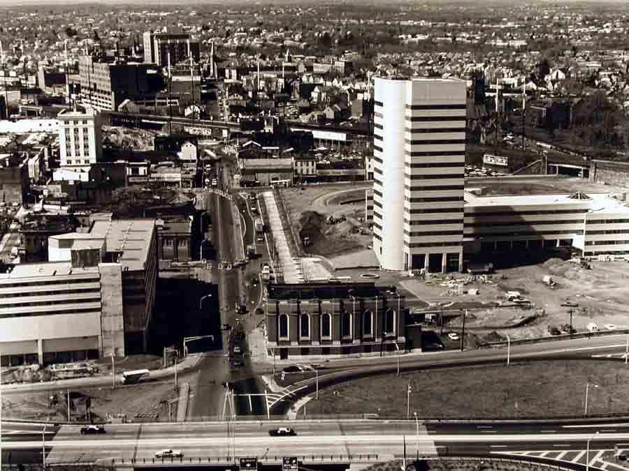
Someone recently took a photo of New Brunswick from an airplane on a flight path for landing at Newark.The Star-Ledger reports that the photo has gone viral:
"The photo is now the sixth-most popular post of all time on Reddit’s New Jersey page, according to Kastner.I think it says something about aerial photographs, that this simple (but sharp, crisp and well framed) passenger photo has had such an impact.
Number five is a politically incorrect map of New Jersey, he said."
08 March 2013
It’s Scholarship Season!
This is a great time of year for our students because there are so many different opportunities for scholarship and other awards. Our scholarship committee has compiled a list of scholarship opportunities that Rutgers’ students should be looking closer at.
The deadline for SEBS scholarship applications
is NO LATER THAN APRIL 12, 2013.
07 March 2013
Genius quote
“Genius is the capacity to see ten things where the ordinary person sees one.”
– Erza Pound
06 March 2013

Lecture notes
Roger Tomlinson in the movie Data for Decision
Part 1 (SLYT)
Part 2 (SLYT)
Part 3 (SLYT)
MLMIS land records inventory
How Computer mapping at Harvard Became GIS
3 Landscapes
Cheonggyecheon restored river
Park Güell
Biltmore Estate
Part 1 (SLYT)
Part 2 (SLYT)
Part 3 (SLYT)
MLMIS land records inventory
How Computer mapping at Harvard Became GIS
3 Landscapes
Cheonggyecheon restored river
Park Güell
Biltmore Estate
05 March 2013
Alum in the news
A recent graduate of the geomatics program, Trevor Raynor, is in the news for going around Middlesex County and setting fires.
Hold the date
26th Annual NJDEP GIS Mapping Contest!
GIS
users from federal, state, county, municipal, local government, and
non-profit agencies, as well as students are eligible to enter the
contest. Attendance is open to all.
Theme: Hurricane Sandy - Response & Recovery
When: Thursday April 18, 2013
Time: 10:00 a.m. - 12:00 Noon
(Contestants please arrive by 9:15)
Where: First Floor - Public Hearing Room
NJDEP Building, 401 E State St, Trenton, NJ
Please
join NJDEP for the Annual Mapping Contest. The event features the best
non-commercial mapping in the State of New Jersey. Review the rules,
categories and register online at the NJDEP GIS web site: http://www.nj.gov/dep/gis.
We ask that all contestants pre-register (registration will open in
mid-March) and submit a digital copy of their map after registration is
confirmed.
This
year we expect to see many maps generated as a result of Hurricane Sandy
but any map that pertains to New Jersey is eligible (see the contest
rules on the web site).
For Mapping Contest questions contact the Bureau of GIS Help Desk at 609-777-0672 or gisnet@dep.state.nj.us.
03 March 2013
Cool design in Thailand
Land8Lounge has great galleries of photography of landscape architecture. As a general rule I encourage readers to head over there when looking to stimulate the eyes.
Today I am singling out a specific gallery set for Pause Court and Lawn Hill in Thailand.
01 March 2013
A week of interchanges: New Jersey
After posting over 300 of these photos, I do think that NJ stands out a little. While it has a surprisingly small number of Interstate interchanges (lots of highways, only a few Interstates) many of ours are more varied and interesting than some other states. Not necessarily something to be proud of, but visually stimulating no less.
This is the final installment of the week of interchanges. Please feel free to use Saturday as a chance to explore your nearby interchanges for their own creepy beauty.


Subscribe to:
Posts (Atom)


