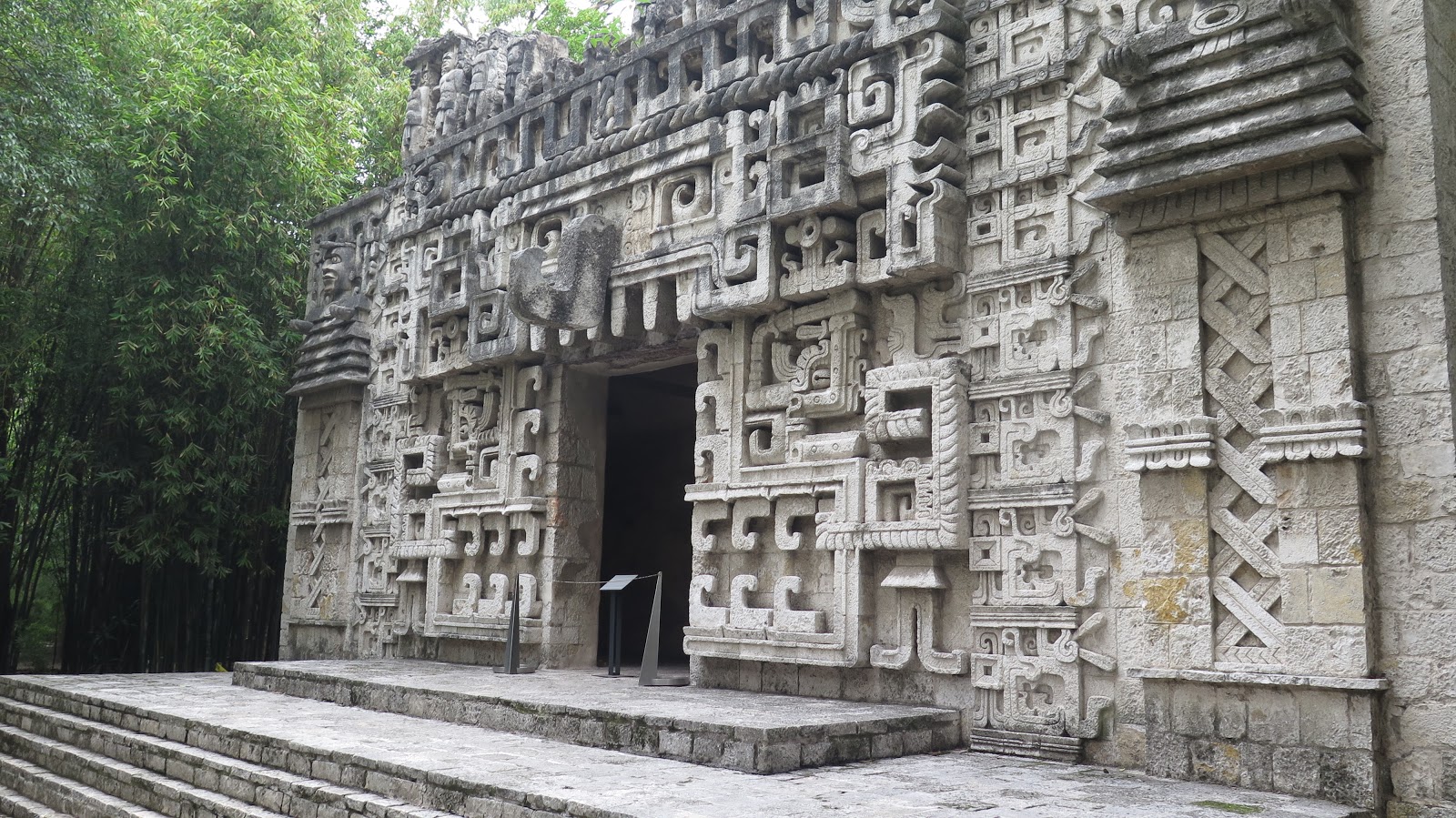
Celebrate CInco de Mayo with some Mexican Landscape Architecture.
I finally made my first trip to Mexico City last year and was amazed.
05 May 2020
Graceland Cemetery
One day after I mention it in class, the Chicago Tribune exhorts readers to visit Graceland Cemetery. After reminding us that the entire cemetery is an arboreal wonderland sprinkled with amazing architecture, including several Louis Sullivan monuments, the columnist drops an exclamation mark on it with a closing sales pitch for the Burnham burial site.
As powerful as the Sullivan-designed monuments are, my favorite place at Graceland is not a work of architecture, but a piece of environmental design — the island in the lake where the architect and urban planner Daniel Burnham and his family are buried. You reach the island by crossing a narrow wood footbridge. It leads to an irregularly-shaped boulder that marks the resting place of Burnham and his wife Margaret.
A canopy of trees offers a sense of shelter, while the water surrounding the island adds a dose of serenity. The lakefront that Burnham championed as a great public space is closed to the public, but here, at least, the visitor can honor the visionary who did so much to create it.
04 May 2020
Coronavirus by town
Hospitalizations are down and the rate of cases is slowing, but the spatial spread continues. There are not many places left in New Jersey that are free from COVID-19. This map shows the rate, by municipality, by date (Cases/100,000).
If we isolate the 20 largest municipalities (by population), the May 1 reported rates still some variability. I've added population numbers (2010) for quick reference. Please remember that these are being made quickly during the outbreak and not with unlimited time to check and confirm. Hamilton Township is in Mercer County.
May 1 rates and 2010 population data
| Reported Cases/100k | 2010 Population | Population Density | |
| East Orange City | 2277 | 64270 | 16395 |
| Gloucester Twp | 433 | 64634 | 2776 |
| Old Bridge Twp | 1142 | 65375 | 1690 |
| Union City | 4052 | 66455 | 51918 |
| Middletown Twp | 647 | 66522 | 1528 |
| Passaic City | 3238 | 69781 | 21604 |
| Cherry Hill Twp | 626 | 71045 | 2939 |
| Brick Twp | 1081 | 75072 | 2316 |
| Camden City | 1015 | 77344 | 7394 |
| Clifton City | 2568 | 84136 | 7361 |
| Trenton City | 1427 | 84913 | 10317 |
| Hamilton Twp | 928 | 88464 | 2199 |
| Toms River Twp | 1178 | 91239 | 1731 |
| Lakewood Twp | 1830 | 92843 | 3700 |
| Woodbridge Twp | 1438 | 99585 | 4148 |
| Edison Twp | 1290 | 99967 | 3263 |
| Elizabeth City | 3164 | 124969 | 8984 |
| Paterson City | 3416 | 146199 | 16824 |
| Jersey City | 2127 | 247597 | 15611 |
| Newark City | 1958 | 277140 | 10574 |
30 April 2020
Hands-on student learning in food production
Here is a great story about students getting hands-on experience in research and agribusiness here at Rutgers SEBS. It shouldn't be a big surprise. It shouldn't be a surprise, these students are getting help from people with a deep concern for students. It is interesting to read it with an eye to how we sustain these successes during a time of isolation.
NJ Cities with COVD
Going through yesterday's reports on COVID cases (which probably already lag a little), there were 22 cities and towns in New Jersey with over 1,000 cases. Four of those are in Middlesex County alone. For much of our mapping we have focused on rates (cases/100,000), but for these cities, the actual numbers are important. Imagine trying to track that many cases, or even simply trying to contact them. The cases from the 22 municipalities combine to represent 41% of the cases in New Jersey. Of the 565 municipalities in New Jersey, only about a dozen do not report cases. That leaves the potential for about 550 separate places to watch and address coronavirus in NJ.
Newark, Jersey City, Paterson and Elizabeth are the largest municipalities by population, so it is no surprise seeing them in those same spots on the list. But usually I expect to see Edison and Woodbridge next, so it is interesting to see Passaic with the 5th most cases even though it is the 15th largest by population. Here is the list for "on or close to" April 29th.
Newark 5,300
Jersey City 5,144
Paterson 4,751
Elizabeth 3,953
Union City 2,678
Passaic 2,172
North Bergen Township 2,095
Clifton 2,094
West New York 1,668
Lakewood Township 1,668
Perth Amboy 1,614
Plainfield 1,451
East Orange 1,420
Woodbridge Township 1,404
Union Township 1,404
Edison Township 1,252
Hackensack 1,125
Trenton 1,120
New Brunswick 1,113
Irvington Township 1,112
Toms River Township 1,060
Linden 1,046
The number of cases reported is a fairly one-dimensional representation of the situation (add in uncertainty about reporting, testing, etc. and it gets even tougher). But it is worth noting that while none of these appeared to yet be going down, few are growing nearly as rapidly as they were a week ago. Just remember that these numbers are constantly changing and not something easy to double-check.
Newark, Jersey City, Paterson and Elizabeth are the largest municipalities by population, so it is no surprise seeing them in those same spots on the list. But usually I expect to see Edison and Woodbridge next, so it is interesting to see Passaic with the 5th most cases even though it is the 15th largest by population. Here is the list for "on or close to" April 29th.
Newark 5,300
Jersey City 5,144
Paterson 4,751
Elizabeth 3,953
Union City 2,678
Passaic 2,172
North Bergen Township 2,095
Clifton 2,094
West New York 1,668
Lakewood Township 1,668
Perth Amboy 1,614
Plainfield 1,451
East Orange 1,420
Woodbridge Township 1,404
Union Township 1,404
Edison Township 1,252
Hackensack 1,125
Trenton 1,120
New Brunswick 1,113
Irvington Township 1,112
Toms River Township 1,060
Linden 1,046
29 April 2020
Lancet paper on access in Colombian
Excited to share that our research team, led by Dr. Hanna and Dr. Peck, has published Use of the six core surgical indicators from the Lancet Commission on Global Surgery in Colombia: a situational analysis in The Lancet Global Health.
Part of what made this possible was a commitment by Colombia to keep good records across their entire nation. Part what it took was a large team with diverse backgrounds and skills. And part of it was a leadership with a vision sustained over years. There is plenty left to do. Updates and refinements and comparisons with other factors. But this was a huge step and I am proud to have been part of this amazing team.
Working in Colombia has given me a great chance to discover an amazing country. And the diversity of its landscapes produce some pretty amazing challenges to access to emergency surgical care. Mapping those with and without 2-hour access, was only the first of the six indicators, but it helped illustrate how much both the physical and cultural landscapes of Colombia shaped that access.
Part of what made this possible was a commitment by Colombia to keep good records across their entire nation. Part what it took was a large team with diverse backgrounds and skills. And part of it was a leadership with a vision sustained over years. There is plenty left to do. Updates and refinements and comparisons with other factors. But this was a huge step and I am proud to have been part of this amazing team.
28 April 2020
Exploring coronovirus over time
The GeoHealth Lab @ CRSSA has been exploring municipal patterns of COVID-19 in New Jersey. With 565 municipalities, this is a fairly detailed look at the movement of the virus across the landscapes of the Garden State. It is fraught with challenges since not all municipalities are reporting these numbers every day, they may not be using consistent definitions, and the municipalities range wildly in area and population. While we are culling these data from a variety of sources - tweets by mayors, county web sites, various newspapers - the reporters at NJ.com have not only been publishing numbers, but they published a great explanation of why you should be wary of these data. In that spirit, these early data visualizations are offered as a rapid response.
While you should be careful in reading these data, as longitudinal data they display some remarkable patterns. Eventually there will be more carefully checked data that is presented in carefully balanced representations. But as we are currently surrounded by this pandemic, we should see what we can in the moment. As a simple example, we can start just comparing the reported rates (cases per 100,000 residents) for just a few cities:
Early reports asked why New Brunswick (yellow) wasn't experiencing growth as fast as a few other cities, but the graph shows New Brunswick (blue) catching up with Newark's rate in recent days. There is also a spatial pattern implied, as the southern cities lagged - it seems that northern New Jersey started first but Trenton is starting to catch up. Will Atlantic City (light blue at the bottom) see a later jump in its rate? The answer to that will have policy implications for the statewide shutdown.
Having suggested that the pattern is spatial, what we need is a map that shows us the changes over time. Here is an animated GIF tracking the municipal data from March 31 to April 27. (If it isn't animated for you, you can download it or refresh this page.)
The first time through you might just notice that the map gets darker. But with a second run through the animation you might notice that it starts with higher rates in Bergen County and spreads West and South. As it does, you can also see that it moves like a wave, washing across both large and small towns.
To see if large cities were having similar experiences, we selected out the 20 largest municipalities in New Jersey by population. For each of these, we graphed their change in reported rates over time. With so many squiggles it is hard to pick out just one town, but the legend shows their rankings and. more importantly, the graph shows that most of them are experiencing similar trends (consistent growth), but at decidedly different rates. Again, don't get lost in details, since these data could still use some polish. But the big pattern can help identify where to watch in the coming days.
While you should be careful in reading these data, as longitudinal data they display some remarkable patterns. Eventually there will be more carefully checked data that is presented in carefully balanced representations. But as we are currently surrounded by this pandemic, we should see what we can in the moment. As a simple example, we can start just comparing the reported rates (cases per 100,000 residents) for just a few cities:
Early reports asked why New Brunswick (yellow) wasn't experiencing growth as fast as a few other cities, but the graph shows New Brunswick (blue) catching up with Newark's rate in recent days. There is also a spatial pattern implied, as the southern cities lagged - it seems that northern New Jersey started first but Trenton is starting to catch up. Will Atlantic City (light blue at the bottom) see a later jump in its rate? The answer to that will have policy implications for the statewide shutdown.
Having suggested that the pattern is spatial, what we need is a map that shows us the changes over time. Here is an animated GIF tracking the municipal data from March 31 to April 27. (If it isn't animated for you, you can download it or refresh this page.)
The first time through you might just notice that the map gets darker. But with a second run through the animation you might notice that it starts with higher rates in Bergen County and spreads West and South. As it does, you can also see that it moves like a wave, washing across both large and small towns.
To see if large cities were having similar experiences, we selected out the 20 largest municipalities in New Jersey by population. For each of these, we graphed their change in reported rates over time. With so many squiggles it is hard to pick out just one town, but the legend shows their rankings and. more importantly, the graph shows that most of them are experiencing similar trends (consistent growth), but at decidedly different rates. Again, don't get lost in details, since these data could still use some polish. But the big pattern can help identify where to watch in the coming days.
Keep an eye out for updates. There is plenty more in the pipeline.
24 April 2020
Different scenarios for the fall
Inside Higher Ed has come up with 15 different scenarios for the Fall semester. And, having already posted those, they are now exploring each with a deeper dive (e.g., The Late Start). For planners, scenarios are an important first step in addressing uncertainty.
3-d printing PPE at Rutgers
Rutgers' Dr. Joseph Hanna is making sure that his coworkers at the hospital have additional protection from COVID-19, so he started making parts with a 3-d printer. Now there are people working all over Rutgers to help create extra PPE for Dr. Hanna and his fellow front line workers.
22 April 2020
RotD: Books
Q. I have some extra time this
summer/semester/winter and would like to read an extra book or two. Can
you suggest anything good?
A. It depends on your interest.
A) An easy avenue to consider as a start would be to get some recent issues of Landscape Architecture Magazine which is published by the American Society of Landscape Architecture and is meant as their semi-official portrayal of the state of the profession.
B)
For environmental planning students I frequently recommend the
following (although some are recommended as examples of trends that I
may or may not fully endorse):
Ian McHarg's Design With Nature and A Quest for Life.
Duany, Plater-Zyberk, and Speck's Suburban Nation: The Rise of Sprawl and the Decline of the American Dream.
James Howard Kunstler's Geography of Nowhere: The Rise and Decline of America's Man-Made Landscape.
Oh, what the heck. Maybe you should just pick from Planetizen's Top 20 Planning Books list for this stuff. (Or their latest, the Best of 2019)
C) For those who are trying to move up from entry level students to serious students of landscape architecture, here is an edited version of the list Dr. Shearer prepared for some our past design students:
John Stilgoe, Common Landscapes of North America.
His first major work, this book examines how North America has been
intentionally shaped from the colonial era through the early nineteenth
century by non-designers. Topics include measures taken by
government--such as the Ordering of Towns which was penned before the
Puritans stepped off the Arabella, the Spanish Law of the
Indies, and the Jefferson-era Northwest Ordinance; by farmers--how
northerners made fences to keep things in vs. how southerners made
fences to keep things out and why barns are red; and by what might be
considered visionary industrialists--such as the people who funded the
Pennsylvania Turnpike and the Erie Canal. As one might expect, this book
is chock full of historical facts, but its real strength is that
demonstrates how "traditional" practices for shaping the landscape are
not conventions to be followed uncritically. Instead, they are based on a
complex combination of ideals and practicalities. At a minimum, this
book would complement your landscape history class in that it describes
the "non-art" shaping of the environment. But separate from that
potential, I think this book would be of interest to everyone,
regardless of whether you are in the landscape architecture, landscape
industry, or environmental planning & management programs.
John Stilgoe, Outside Lies Magic. Relatively short and very approachable, this book was written for a broad audience and intended to get everyone to go outside, look around, and think about the implications of what they see. For example, how does the US Post Office organize space and how, in turn, do we--in part--live by that organization?
John Stilgoe, Landscape and Images. This book is a compilation of some of JRS' articles and essays. Topics include the role of photography in shaping our understanding of the landscape (for better and worse), the specter of hobgoblins in suburbia, and bikinis. This book came out last year through the University of Virginia Press and I do not know if it is available as a paperback yet.
Simon Schama, Landscape and Memory. Schama is another historian, but unlike Stilgoe does not focus on the environment. (For example, a previous book was on Dutch painting and he has recently been compiling a multivolume history of the Britain.) As a result of his range, he is not as insightful on particular points about landscape change, but his breadth makes connections that a more specialized mind might miss. Some of the places described in Landscape and Memory will be familiar to you from your landscape history class; others--like Mount Rushmore--you will know from elsewhere. What I think is useful about this book is its organization: Rather than go through a discussion of these sites by time or by location, it is arranged in three parts by material: wood, water, and rock. This perspective can help you re-think not only what you learned in your history class, but how you might apply design themes based on materials in studio.
William Cronan, Natures Metropolis. If you are looking for patterns in this list, Cronan is also an historian. If he has a fault, it would be that he occasionally sentimentalizes some activities associated with shaping the environment. That particular problem is not so evident in this history of Chicago in which he describes how the idea (the promise?) of "progress," natural resources, and technology combined to create a new kind of urban condition. I recommend this book not because I think everyone should know about America's second city, but because it lays out, in clear language, how possibilities can be combined to create something bigger than most people can imagine. Whether or not such things should be built is another question, but it is happening at a rapid clip in China as you read. Admittedly, this book will be of more obvious interest to those in the environmental planning & management program, but it could help everyone think about the built environment.
J. Nicholas Entrikin, The Betweenness of Place: Towards a Geography of Modernity. This book is not an easy read: most graduate students need to keep a very good dictionary at hand, and you will want to (or need to) pause and think about what is expressed after each and every page. In essence, Entrikin tries to synthesize two opposing ways we understand the creation of regions. On the one side, there is the German "science of space" view which holds that law-like forces of change operate universally over time. On the other side is the French, "description of place" view which holds that regions emerge from entirely idiosyncratic opportunities and decisions. If you can get through it, it will help you to understand arguments of geographic limitation-determinism.
Gaston Bachelard, The Poetics of Space. If you pick up Kevin Lynch and Gary Hack's Site Planning, you will be able to start applying what you read very quickly; It's just that kind of book. The Poetics of Space is the opposite in term of easy application, but it is arguably as important. You do not "use" this book. Instead, you live with it, and as you do it infuses your own ideas and makes them richer. Most of the points are made in terms of architecture—and indeed, this book is read by just about every architect at some point in his or her education—but do not let that get in the way of you reading it. (Stilgoe thought it important enough that he wrote an introduction to one of the more recent editions.)
Edward T. Hall, The Hidden Dimension.
Hall is an anthropologist who writes on a variety of issues that
frequently go unnoticed in daily life because they are so ingrained in a
culture. In this book he examines what might be considered the dynamics
of personal space and indirectly, what designers might do to influence
how social places are designed.
Niall Kirkwood, The Art of Landscape Detail and Weathering and Durability in Landscape Architecture. Kirkwood now deals with bioremediation and other technologies for brown field sites, but his first book and follow-up were careful studies of construction details. On the surface, they are about what combinations of material and forms work, what do not work, and why. However, their underlying premise is that for site scale design to be successful, the ideas of the larger scheme should be expressed in the thoughtful execution of the smallest elements. Admittedly, most books on building details are hopelessly dull and this text might suffer a certain lack of glamour. But if you want to further explore how a curb or a flight of steps might matter and, moreover, how thinking about these things might contribute to a richer design process, then these books are worth a look. Also of note, when I last looked, they were quite expensive.
James Corner [Editor], Recovering Landscape: Essays in Contemporary Landscape Architecture. Corner was the Chair of the Landscape Architecture Department at the University of Pennsylvania. Some of the essays in this collection are difficult to read, but if you are interested in wrestling with big ideas, it is a good place to start.
Giuliana Bruno, Atlas of Emotion: Journeys in Art, Architecture, and Film.
Another disclaimer: I was GB's teaching fellow for several years. There
is "smart," there is "really smart," and there is "scary smart"—so
smart that you are glad the person uses their mind for good and not to
rule the planet for their own enrichment. Giuliana Bruno is scary smart.
This book is about the relationship between seeing and traveling, about
the "motion" in emotion. That topic alone makes it engaging, but what I
think is even more important about this book is the way it brings
together different arts.
Malcolm McCullough, Abstracting Craft: The Practiced Digital Hand. During pin-ups and reviews we have talked about how the making of drawings and models is a matter of craft—of knowing about the qualities of materials and how they can be shaped for a certain effect. Very soon you will be making representations with a computer in addition to with a lead holder and chipboard and you might be wondering, is there such a thing as "digital craft"? After all, most AutoCad plots look as if they could have been made by anyone any time. McCullough, who was trained as an architect and urban planner, thinks that digital craft does exist, even if the ideas of craft are not discussed or taught in a computer lab. This book places digital media within a larger context of visual arts. It will not teach you how to make the most of the Photoshop magic wand tool, but it will introduce you to a way of thinking about your efforts with keyboard and mouse that will lead to better works.
Douglas Cooper, Drawings and Perceiving: Life Drawings for Students of Architecture and Design. Cooper teaches at Carnegie Mellon and this book might be considered a translation or adaptation of the well known The Natural Way to Draw by Kimon Nicholaides for designers. The instructions and exercises are quite good.
Robert W. Gill, Basic Rendering. This book is all about black and white rendering. Its strength is its discussion of how light behaves on the objects around us. It will help you to become a master of stippling.
20 April 2020
What's next?
For the long term recovery, I am pondering the ideas in
The Hammer and The Dance. It was posted on March 10 and has gotten serious
attention. Today the author posted a follow up called
Coronavirus: Learning How to Dance, Part 1: A Dancing Masterclass, or What WeCan Learn from Countries Around the World. Much of what he is saying is Public Health 101. But he
puts it together remarkably well (and I suspect with the support of an
impressive staff).
For my students I encourage them to think about: What will it mean for higher education? What will it mean for planning and design? For employment over the next five years?
But I am also curious about what it might mean about the geospatial patterns in COVID-19. And, as we look at other countries, I can't help but notice that are landscapes will not be like theirs. Even those with sprawl do it differently than us. Food access is different. Workplaces are different. Movement across those landscapes is different too. So surely the maps of the roller coaster ride will look different too.
17 April 2020
Park safety?
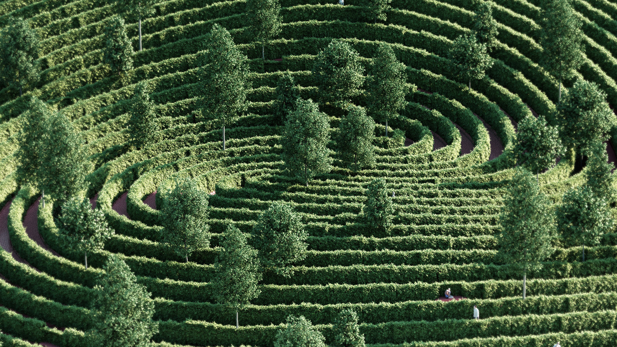
Dezeen reports on a proposed design by Precht that enforces social distancing.
"What would a park look like and how would it function if it takes the rules of social distancing as a design guideline. And what can we learn from a space like this that still has value after the pandemic."
16 April 2020
SCOTUS on tape
As Supreme Court cases are argued, the oral arguments bring a little personality into the process. Oyez let's you listen to recordings of the oral arguments and hear those moments when the personalities come through. Like this moment from Kelo v New London when we were left wondering what those four words were.
"And just -- I would say that in this case, the essence of federalism is to let various courts make various decisions about what they consider an important public purpose. It may be different in Utah from the way it is in Connecticut, and it's different in Florida, and I don't think this Court should be having a new jurisprudence for this area and having two separate tests, and maybe having a test that even approaches the Nollan Dolan test where you certainly want to discourage people from taking these actions. And so it seems to me the four words I think that this Court should consider -- and I'm not going to tell you the four words since my red light is on. Thank you, Your Honor."Justive Kennedy asked the opposing attorney if he knew those four words, but he did not.
13 April 2020
What is a megadrought?
Looking at soil moisture and tree rings, researchers are becoming increasingly concerned about a megadrought in the desert southwest.
“Earlier studies were largely model projections of the future,” said lead author Park Williams, a bioclimatologist at Columbia University’s Lamont-Doherty Earth Observatory. “We’re no longer looking at projections, but at where we are now. We now have enough observations of current drought and tree-ring records of past drought to say that we’re on the same trajectory as the worst prehistoric droughts.”It isn't just that there are markers of a dry future. But a broad historic context also recognizes that, throughout the 20th Century, as Arizona made long-term decisions about sprawling development patterns, it was experiencing an unusually wet century. Now that the Southwest is committed to supporting those sprawling landscapes, a megadrought is a dramatic change.
09 April 2020
Context quote
You can know the name of a bird in all the languages of the world, but when you’re finished, you’ll know absolutely nothing whatever about the bird . . . So let’s look at the bird and see what it’s doing – that’s what counts.
- Richard Feynman
- Richard Feynman
07 April 2020
I wandered lonely as a cloud
Today would have been William Wordsworth's 250th birthday
I wandered lonely as a cloud
That floats on high o'er vales and hills,
When all at once I saw a crowd,
A host, of golden daffodils;
Beside the lake, beneath the trees,
Fluttering and dancing in the breeze.
Continuous as the stars that shine
And twinkle on the milky way,
They stretched in never-ending line
Along the margin of a bay:
Ten thousand saw I at a glance,
Tossing their heads in sprightly dance.
The waves beside them danced; but they
Out-did the sparkling waves in glee:
A poet could not but be gay,
In such a jocund company:
I gazed—and gazed—but little thought
What wealth the show to me had brought:
For oft, when on my couch I lie
In vacant or in pensive mood,
They flash upon that inward eye
Which is the bliss of solitude;
And then my heart with pleasure fills,
And dances with the daffodils.
Isolation on the AT
Maybe you remember the story a couple years ago about an artist who moved to Ohio and disconnected from all news and social media. The NY Tims called him "the most ignorant man in America."
Thanks to a robust National Park system, we have a less intentional version. An AP reporter interviewed Appalachian Trail thru-hikers who were startled to discover that the world had been shut down while they were walking in the woods. Already this spring, quite a few intrepid hikers had headed out to make the roughly 6 month trek. After quitting their jobs and disappearing into the woods, they would briefly emerge for food or showers only to be greeted by what must have seemed like unbelievable news about the global public health crisis.
As the pandemic grows, hikers face the difficult decision to postpone their dreams or ignore warnings and forge ahead. Like virtually every other entity in the U.S., the Appalachian Trail Conservancy began issuing COVID-19 safety guidance in March. But social distancing and hand-washing suggestions soon shifted to urging all hikers to leave the trail immediately. Shelters and privies were shut down, and volunteer programs were halted. On Wednesday, the conservancy and 29 other trail-maintaining clubs asked federal officials to close the trail until the end of the month.While the AT seems sufficiently isolated to be safe, it is also sufficiently isolated to be a dangerous place if you experience a sudden onset of symptoms. Also, many thru-hikers forgo a tent and rely on the shelters at night, so their closure makes things a bit trickier for those who try to ignore the advice. This might be an interesting story to continue to watch over the year as a few people ignore the advice and try to complete the 2,000 mile trip.
04 April 2020
Incoming
Just because classes moved online does not mean that news has stopped. The Daily Targum reports that Laura Lawson will become the Interim Executive Dean for the School of Environmental and Biological Sciences.
02 April 2020
3d printers for PPE
One of my collaborators has found a way to save lives by using a 3d printer to produce PPE. As an acute care surgeon, Dr. Joseph Hanna is not only looking out for patients, but by producing PPE he is helping protect more colleagues. Very cool.
31 March 2020
Lake shore erosion
It is easy to mistake the Great Lakes as stable and calm - they are just lakes and immune from sea level rise. But, residents of the Upper Midwest know that are more like incredibly active and dangerous inland seas, home to dramatic storms and fabled shipwrecks, and subject to damaging changes in levels.
The current changes in levels are making a visible impact along the Lake Michigan's shore in Indiana. Over the weekend, the Indianapolis Star published a serious, in-depth look at the issues and problems involved in this complicated environmental change.
First, the 2,000 word feature sets the stage by reminding us that this is a serious force of nature. They focus on a road near the lake that is getting severely undercut:"Lake Michigan is at near record levels,15 inches above this time last year. Its waves, which can top 20 feet during storms, are now chewing away at the earth underneath the road."
Then it talks about several different communities, illustrated with useful photos and videos. For our environmental planning class this is helpful in pointing out how the fractured nature of the jurisdictional landscape.
And it argues that this isn't just a local problem. That shoreline is home to America's newest National Park: Indiana Dunes NP. And that makes it all a problem that belongs to all of us. But the neighbors aren't so happy, since the National Park (and the US Army Corps of Engineers) oppose letting some parts of these communities use intensive built structures to fight back against nature. (I am sure there is more to it, but you get the idea)
If you think lakeshore erosion isn't a serious thing, just watch the waves in this video.
The current changes in levels are making a visible impact along the Lake Michigan's shore in Indiana. Over the weekend, the Indianapolis Star published a serious, in-depth look at the issues and problems involved in this complicated environmental change.
First, the 2,000 word feature sets the stage by reminding us that this is a serious force of nature. They focus on a road near the lake that is getting severely undercut:"Lake Michigan is at near record levels,15 inches above this time last year. Its waves, which can top 20 feet during storms, are now chewing away at the earth underneath the road."
Then it talks about several different communities, illustrated with useful photos and videos. For our environmental planning class this is helpful in pointing out how the fractured nature of the jurisdictional landscape.
And it argues that this isn't just a local problem. That shoreline is home to America's newest National Park: Indiana Dunes NP. And that makes it all a problem that belongs to all of us. But the neighbors aren't so happy, since the National Park (and the US Army Corps of Engineers) oppose letting some parts of these communities use intensive built structures to fight back against nature. (I am sure there is more to it, but you get the idea)
If you think lakeshore erosion isn't a serious thing, just watch the waves in this video.
30 March 2020
Utopian community: New Harmony
An example of a utopian plan for a community is New Harmony, Indiana. Horrified by the urban nightmares of industrialized and overcrowded 19th Century cities like London and New York, New Harmony was offered planned as a utopian alternative. Demonstrating the power of flexible idealism, it even survived a generational change from religious separatists to secular reformers. With buildings by Philip Johnson and Newark-native Richard Meier, it also features built architecture that continues to strive to lift people up and change lives.
29 March 2020
Using Geography in the Fight Against the Pandemic.
Another good story about GIS as one tool in the comprehensive fight against COVID-19 in, Using Geography in the Fight Against the Pandemic. It includes John Snow and a cautious message about using GIS as a complement to other tools and technologies. Most importantly, the article quotes Assistant Professor Jennifer Whytlaw who is a Rutgers alum.
28 March 2020
Peter Wacker
When I first came to Rutgers, Peter Wacker was quick to welcome me. He and I had both attended LSU for graduate school and, despite having few mutual acquaintances there, we shared connections to remarkable places in the Louisiana landscapes. He was also an incredible advocate for New Jersey and schooled me an appreciation for the landscapes I was discovering here in his home state.
Before I knew it, I found myself on graduate committees with him where I got to watch him in action as an educator. These were some of my first experiences as a graduate faculty member and were incredibly formative. But I made the mistake of thinking he was just innocuous friendly faculty member. As I began to attend meetings in other corners of Rutgers and all across New Jersey, I discovered that he was an academic celebrity. Every one seemed to know him, counted on his expertise, read his writings, and wanted to be sure I knew him too. But which Professor Wacker were they telling me about? The geographer? The historian? The expert on NJ land use? The researcher? The teacher? There seemed to be many Peter Wackers all leaving an indelible mark on New Jersey.
Sadly, we lost Peter Wacker this week. I expect that there will be a few other detailed professional obituaries later. But a first obituary is posted for those who did not know him as well.
Before I knew it, I found myself on graduate committees with him where I got to watch him in action as an educator. These were some of my first experiences as a graduate faculty member and were incredibly formative. But I made the mistake of thinking he was just innocuous friendly faculty member. As I began to attend meetings in other corners of Rutgers and all across New Jersey, I discovered that he was an academic celebrity. Every one seemed to know him, counted on his expertise, read his writings, and wanted to be sure I knew him too. But which Professor Wacker were they telling me about? The geographer? The historian? The expert on NJ land use? The researcher? The teacher? There seemed to be many Peter Wackers all leaving an indelible mark on New Jersey.
Sadly, we lost Peter Wacker this week. I expect that there will be a few other detailed professional obituaries later. But a first obituary is posted for those who did not know him as well.
26 March 2020
MIchael Sorkin
The obituaries of Michael Sorkin will struggle to capture all of his work: architect, theorist, urbanist, author, professor. I will be interested to see which projects they list as his most prominent. But I am still struck by his comments about the Oculus in his 2016 piece, The Cathedral at Ground Zero.
I really like the big beast as both object and space, and already feel sad about its imminent squishing between the two crappy towers that will flank it. If only it could just walk—or fly—away! Indeed, Calatrava had originally wanted its wings to flap, and I sympathize with his disappointment that this motility was value-engineered into stasis.I hope his passing doesn't get lost in a tidal wave of sad news. He touched a lot of designers, planners and students and worked to make so many cities better.
Camp Pendelton alternatives futures report
Here is a link to the Camp Pendeleton alternative futures report from Harvard GSD in 1997. It is amazing to go back a see it again.
25 March 2020
23 March 2020
1910 aero-Map of New Brunswick
The Library of Congress has a rich Digital Collection that we access pretty often. One of my favorite pieces is the panoramic map of New Brunswick from 1910 with so many richly drawn details, surrounded by photographs capturing that moment in the city's history.
The environmental art of Stuart Ian Frost
Stuart Ian Frost does unimaginable things to trees.
I recommend you start with
The Broken Oak
Embla
Skin Deep
Fagus
Loop
A Place is a place is a place from Sculpture in the Wild on Vimeo.
I recommend you start with
The Broken Oak
Embla
Skin Deep
Fagus
Loop
A Place is a place is a place from Sculpture in the Wild on Vimeo.
22 March 2020
Research Paper: Mapping COVID-19
Maged Kamel Boulos, a Chinese researcher, and Este Geraghty, Chief Medical Officer at Esri, have a new research paper out examining various online GIS-enabled tracking of COVID-19.
Kamel Boulos, M.N., Geraghty, E.M. Geographical tracking and mapping of coronavirus disease COVID-19/severe acute respiratory syndrome coronavirus 2 (SARS-CoV-2) epidemic and associated events around the world: how 21st century GIS technologies are supporting the global fight against outbreaks and epidemics. Int J Health Geogr 19, 8 (2020). https://doi.org/10.1186/s12942-020-00202-8

The paper makes some interesting points about availability and timeliness of data comparing information access duing Chinese New Year (2020) with the Hajj (2014). Along with the recent Lancet article on the JHU dashboard, this may become a must-cite for health geography for quite a while to come.
12 March 2020
National Park posters
Someone has taken the idea of the 1-start Yelp reviews of National Parks and created fantastic looking Subpar Parks posters.
11 March 2020
Vocabulary enhancement
Here is a word I learned in the NRCS Soils Survey today:
Varve
A sedimentary layer or a lamina or sequence of laminae deposited in a body of still water within a year. Specifically, a thin pair of graded glaciolacustrine layers seasonally deposited, usually by meltwater streams, in a glacial lake or other body of still water in front of a glacier.(A slightly simpler definition is at Dictionary.com)
02 March 2020
Colombian commuting
Commuting is fascinating and complex and dreadful. Commuting in Colombia is especially complicated as they have 3 rush hours. A new piece at CityLab provides fascinating maps of Medellin commuting patterns that illustrate a financial disparity in commuters: "The researchers also found that commuting time decreases as
socioeconomic class increases, due not only to smaller distances but
also more efficient modes of transportation."
As someone studying access to treatment in Colombia, this is another reminder of how much travel time shapes the ultimate outcomes of access. For those with limited mobility, this would be especially true.
27 February 2020
Global Development
How Can Evaluation Improve Sustainable Development?
Understanding the Nexus of Natural and Human Systems
Monday March 2nd – 2:15 –3:30 pm
Institute for Food, Nutrition and Health
Cook Campus
Rm. 101
Dr. Juha I. Uitto, Director
Independent Evaluation Office, Global Environment Facility
Evaluating environmental programs and projects in developing countries.
Drawing on over two decades of global evaluation experience, Dr. Uitto highlights the strategic role evaluators play in understanding and enhancing the impact of environmental programs and projects in developing countries. Understanding the differing geographic and time scales of natural and human systems is crucial to assessing the complex dynamic systems in which the interventions operate and interact. This is a needed corrective to the usual approach to evaluation, as in policymaking generally, in which the environmental foundation has received relatively less attention. Dr. Uitto will also discuss the use of geospatial data and analysis for improving international development evaluations.
The GEF (http://www.thegef.org/) has provided close to $20 billion in grant funding and mobilized an additional $107 billion in co-financing to more than 4,700 projects in 170 countries. Following his talk, Dr. Uitto will be available to discuss international internships and project work opportunities with interested graduate students and faculty.
Contacts: Prof. Hal Salzman HSalzman@Rutgers.edu or Dr. Marjorie Kaplan mbk65@envsci.rutgers.edu
Sponsored by: Rutgers Global, Rutgers EJ Bloustein School of Planning and Public Policy, Rutgers Climate Institute, International Development Interest Group and offered as part of E.J. Bloustein School’s “International Development” course.
Monday March 2nd – 2:15 –3:30 pm
Institute for Food, Nutrition and Health
Cook Campus
Rm. 101
Dr. Juha I. Uitto, Director
Independent Evaluation Office, Global Environment Facility
Evaluating environmental programs and projects in developing countries.
Drawing on over two decades of global evaluation experience, Dr. Uitto highlights the strategic role evaluators play in understanding and enhancing the impact of environmental programs and projects in developing countries. Understanding the differing geographic and time scales of natural and human systems is crucial to assessing the complex dynamic systems in which the interventions operate and interact. This is a needed corrective to the usual approach to evaluation, as in policymaking generally, in which the environmental foundation has received relatively less attention. Dr. Uitto will also discuss the use of geospatial data and analysis for improving international development evaluations.
The GEF (http://www.thegef.org/) has provided close to $20 billion in grant funding and mobilized an additional $107 billion in co-financing to more than 4,700 projects in 170 countries. Following his talk, Dr. Uitto will be available to discuss international internships and project work opportunities with interested graduate students and faculty.
Contacts: Prof. Hal Salzman HSalzman@Rutgers.edu or Dr. Marjorie Kaplan mbk65@envsci.rutgers.edu
Sponsored by: Rutgers Global, Rutgers EJ Bloustein School of Planning and Public Policy, Rutgers Climate Institute, International Development Interest Group and offered as part of E.J. Bloustein School’s “International Development” course.
26 February 2020
A quick lesson on hydrographs
Here is a quick video tutorial on watersheds and hydrographs. Can you read a hydrograph?
25 February 2020
Presentation tip
A great presentation tip from the GradHacker Blog:
Are you giving a talk to cats? No? Then you should probably put the laser pointer away.
24 February 2020
Soils Quote of the Day
“A cloak of loose, soft material, held to the Earth’s hard surface by gravity, is all that lies between life and lifelessness.”
- Wallace H. Fuller, in Soils of the Desert Southwest, 1975.
22 February 2020
Healthy guiding
Jan Van Haver's story of how Google Maps connected with a healthier lifestyle is just one example of creative thinking about getting people outdoors.
18 February 2020
Mapping very large lakes
Visual Capitalist has posted a pretty amazing mapfographic that compares the 25 largest lakes in the world. The remarkable twist is that it overlays 20 of those on a base map of the 5 Great Lakes, which makes the unfamiliar seem a little more familiar.
17 February 2020
Brian Rose photos of Atlantic City
With many of our students returning from the NJ ASLA meeting in Atlantic City, this is a great time to revisit Terrain.org's photo essay of a series of Atlantic City photos by Brian Rose. The photos and accompanying quotes document the city's troubling juxtaposition of glam and depression.
If you missed the meeting, maybe you should consider the MAC-URISA 2020 meeting in AC.
16 February 2020
Cycling through the canopy
This video captures a remarkable bicycle experience where cyclists can ride a 700m circle elevated through the canopies of trees. For readers looking for more details, Landezine has a beautifully illustrated article about the design. But for the rest, this video is a relaxing hint at this amazing experience.
And, it has been mapped.
Subscribe to:
Posts (Atom)