Comments and news about Environmental Planning and Design. Intended for all audiences including students and alumni of the Rutgers major of Environmental Planning and Design.
The Flood Mapper let's you take a pretty close look at the Jersey Shore and see how much impact storms and sea level rise will have on different areas. There is no denying that this is scary stuff. But Rick Lathrop, stressed to the Wall Street Journal that this is not about scare tactics:
"We are not trying to unduly frighten people," said Rick Lathrop,
director of the Grant F. Walton Center for Remote Sensing and Spatial
Analysis at Rutgers, who led the map's development. "This is providing
people a look at where our vulnerability is."
The tool is very customizable, with slider bars letting the user pick their own scenarios for sea level rise. And it maps more than just SLR. Visitors to the site can also map storm flooding, marsh retreat and social impacts.
Much of our campus here at Rutgers is on hilltops, but these maps shows areas that are still most vulnerable.
Looks like it might be time for folks on the north side of the river to give up on soccer in Johnson and Donaldson Parks and building a boathouse for rowing instead.
The marsh retreat maps around Cape May seem like they have good news, in that they show some areas where future marshes might retreat, although the pink areas are of some concern.
But this flooding map suggests that there may not be as many area residents to see them.
Since junior studio is going to be looking at the Great Swamp Watershed, this might be a special time to get out and see some interesting sites in and near the watershed.
Colonial history lives at the Somerset County Park Commission's annual 1770s Festival when Lord Stirling's grand manor house and estate come to life in Lord Stirling Park in Basking Ridge, NJ. Colonial craftspeople ply their trades and a Revolutionary War military detachment camp on the former estate lawns and conduct maneuvers. The event promotes historical and environmental education by familiarizing people with the rich local history of Basking Ridge, highlighting an unsung Revolutionary War hero, demonstrating the colonial heritage of New Jersey, and recreating a typical autumn afternoon in 1770. In 2006, the Lord Stirling 1770s Festival won the Cultural and History Commission of Somerset County History Award for Education. Period re-enactors attired in replicas of 1770s clothing participate in the festival demonstrating their trades and crafts (no crafts are sold). These crafts people make articles such as buttons, rifles, brooms, furniture, lace, stained glass, redware pottery, and powder horns. Other trades and crafts include a blacksmith, tinsmith, wool spinning, decoy carving, and colonial herbs. Children of all ages enjoy the hayrides, clay crafts using Stirling clay, stenciling, and toy making. Visitors may try on colonial costumes and have their photograph taken while restrained to the Somerset Gaoler's wooden stock. $4 per person suggested donation
Just a few miles south of Morristown is a bowl-shaped valley called the Great Swamp Watershed. This fall our junior studio will be working with locals, particularly the Great Swamp Watershed Association, to investigate and envision alternative futures for these landscapes as part of the Regional Design Studio. Within the context of North Jersey, it looks a little small.
The unusual shape of the valley, and the severity of the hills surrounding it are important to the history of the valley. After the Wisconsin glacier it was the site of the Glacial Lake Passaic and it is still easy to pick out on satellite images. It was also hard to reach so has avoided highways and crossroads of any serious size, adding to its rural character.
Upon closer examination, you can see that the watershed is large enough to include the Great Swamp National Wildlife Refuge. You can see that it also includes most of the Jockey Hollow NPS site. And, the Passaic makes a complete U-turn to get back to its better-known urban environment.
The watershed includes parts of 10 different towns, which used to be represented on the 10 Towns Committee (and the Jersey Jetport Site Association). In 2000, the total population of the 10 towns was under 125,000. While there have been teardowns, add-ons and new commercial sites, it doesn't seem likely that the 2010 census will show this as an area of significant growth relative to its neighbors. The one town with the largest land area in the watershed is Harding Township, which has been working to retain its rural feel for decades.
Several of the remaining towns are very small and sit atop the ridges that constrict the valley and help keep it swampy. The ridgetops have good views and create a special sense of character for the communities.
The location of the watershed places it on or near 2 major commuting highways - I-78 and I-287 - with additional service by NJ Transit. The small towns with great access to Newark and New York include some prestigious, wealthy bedroom communities. But, the Great Swamp itself remains a a little bit of a pain to get to, so the area's residents can feel safe in thinking that future development in the valley is less likely than in other parts of New Jersey.
What is the true Great Swamp watershed like? And what sort of future does it have?
A design competition is close to wrapping up out on Long Island. Build a Better Burb has been juried and has three finalists for the public choice portion. I would encourage our Juniors to study the gallery since the finalists represent a highly varied and imaginative approach to visioning a future for a specific area without getting very site specific.
WNYC's Brian Lehrer had on coastal experts Orrin Pilkey and Rob Young to talk about sea level rise issues that could impact the NY/NJ area. While their new book, The Rising Sea, looks at the larger issues, the radio conversation focused more on specific places like Cape May and Fire Island. Give it a listen.
While we talk about it a little in my geomatics course, we dig in and do it my landscape architecture studio. Last year's class did a particularly strong job in reaching beyond the basic limitations of GIS.
Over at Making Maps blog, John Krygier posted some great student examples of psychogeography maps from a summer camp/class. This isn't very different than some creative explorations that we see in landscape architecture, and emphasize the personal opinion over the factual or spatially precise. Some would argue that may may, in fact, be more truthful if they capture the real truth of the place. But in any case, they may help you think in new ways about your next cartographic effort.
The Light Blue Line is a community activist project to paint a line across our cities. This line would show the level that sea-level would rise to if the Greenland ice sheet completely melted - 7m of rise. The idea is that seeing this worst case, but predictable, indicator in a city like Santa Barbara or New York City forces the residents to confront the reality of our situation. Or should we be worried that people living at 8m will just lazy?
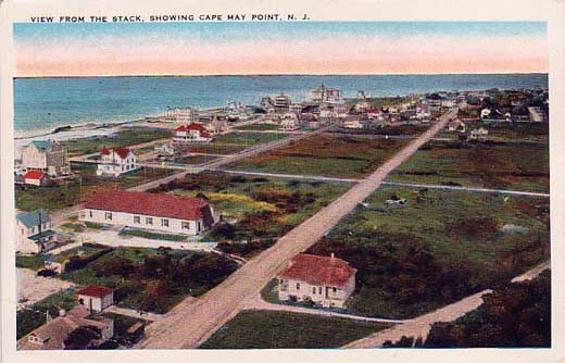
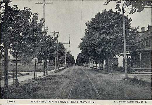
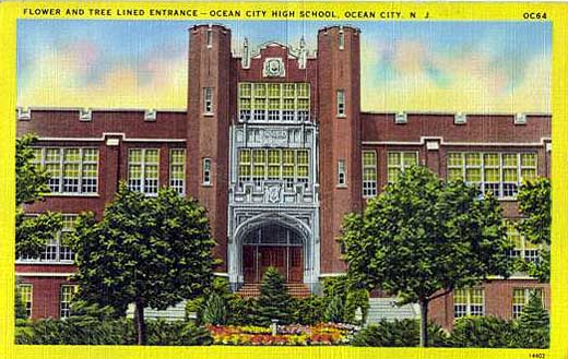
While trying to get to know a little more about Cape May County, I found that WestJerseyHistory.Org has a great collection of postcards online that give a real sense of the place. It is a much more extensive collection than at Penny Postcards.
The international design competition, Rising Tides, has wrapped up with an impressive slate of winning entries. The competition seeking design interventions for coping with sea level rise in San Francisco Bay ended in a 6-way tie that captured a breadth of different approaches to this complex problem. One proposal calls for the construction of a series of lasers showing where a huge dike will need to be built all the way around the bay. Another plan tries to imagine the different kinds of first aid that will be required for different stitches - comparing clean up, stitches and major surgery to protection, operation and adaptation. Two others looked at ways to regulate the tidal flows of the bay with hard or soft structures.
When you think of Cape May, you probably think of old Victorians and great beaches, not a community at risk. This fall in studio, we will be changing our perspective a bit.
While I am still unprepared to reveal all of the final details, I wanted to share the basic outline of our fall studio project for Intermediate Landscape Architecture I (11:550:331). The entire semester will be spent exploring design interventions and implications of sea level rise and global warming in Cape May County, New Jersey with funding assistance from the New Jersey Chapter of the American Society of Landscape Architects.
Cape May County has become the high profile location of an ecological decline that is represented in the falling populations of the interconnected populations of red knots and horseshoe crabs. This got some national attention when PBS aired an entire episode looking at the problem, but has been the focus of research here at Rutgers and at the NJ DEP for some time. It is also a great spot for ecotourism, which would presumably decline quickly as the natural landscapes are degraded.
One of the clear challenges would be to start building an infrastructure now that will better support the future residents of Cape May County. What would high performance infrastructure guidelines tell us about where we should be looking? We aren't the first people to explore these topics, so we need to learn from past studies if we are going to accomplish something new.
The certain threat and the uncertain details make sea level rise, and the larger patterns of climate change, an interesting problem for designers. In the San Francisco Bay Area, concerns about sea level rise (as shown in their local paper) led to the Rising Tides Competition this summer. Hopefully we'll get to see some results this fall before we are too far along in our project. I strongly encourage our students to look back at the IFLA 2008 Student Competition, which gives some great ideas about both the imaginative and serious aspects of this as a design issue.
If you can get out and explore, it would be great. But if you can only get to Trenton, that would work too. The New Jersey State Museum in Trenton also has an exhibit called Rising Tide: Climate Change & Sea Level Rise in New Jersey.
Finally, Places and Spaces will now be an active focused source with at least 3 tags for this project: cape may, JrStudio, sea level rise. Use them to keep up.
Director of SEBS General Honors Program and Professor of Landscape Architecture in Rutgers’ School of Environmental and Biological Sciences and Associate Director of the Grant F. Walton Center for Remote Sensing and Spatial Analysis. Dr. Tulloch can be reached at tulloch[at]crssa.rutgers.edu
Research online at:
https://orcid.org/0000-0002-0692-9190
https://scholar.google.com/citations?user=lOLIQZ8AAAAJ&hl=en
https://crssa.rutgers.edu/projects/geohealth/
The blog currently allows open commenting on posts as a way of creating discussion and dialogue. Please keep comments clean, civil and relevant. Places and Spaces reserves the right to delete all comments, particularly those that are unverified, mean-spirited or undermining the pedagogic intent of the blog.