06 July 2015

Hallowed ground for landscape architects

More than 25 years ago I learned about Generalife and the Alhambra in one of my first college classes and I finally got to visit it this summer. While it was well worth the wait, I gather that if I had gone earlier, there would have been fewer rope barriers in spaces like the Court of Lions. But the restoration work would also not yet have improved some sections.

Not only is this a UNESCO World Heritage site, but it is also on the short list of greatest landscapes anywhere.


30 June 2015

The Lowline

Have you seen the proposal for the Lowline, a subterranean park-like space in Manhattan?  I'm not sure I really get it, but 1,000 donors do. [Mapped]

28 June 2015

Its no fun

An New Zealander  has posted a personal story on Vox.com that emphasizes the unintentional complexity of the immigration system. William Han writes that he has been here strictly legally for 15 years, while acquiring 2 Ivy League degrees, but still found the system too dense for the US to allow this talented resource to remain in the country. If you doubt his talent, just read the excellently told story.

Much of the story revolves around Han's status as the holder of an H1-B visa. I learned a little more about these a few years ago as part of a research team working on the Eagleton Institute's RIIM project. As part of the project we mapped out where the H1-B employers in New Jersey are (almost everywhere) and where the the heaviest users are (the Northeast Corridor). But as Han raised questions about how H1-B workers are treated, I realized the this map might also be a map of posible employer abuses in New Jersey. Check out the entire report, “Meet the Neighbors: Organizational and Spatial Dynamics of Immigrant New Jersey.”


22 June 2015

Water woes

The Washington Post recently published a revealing article on the water crisis in California that suggests this might be harder to fix than some first expected.

h/t JohnB

12 June 2015

NPS tries new approaches

According to the NYTimes, the National Park Service is enhancing the park experiences with more social media, new phone apps, and digital mapping. This should make for an interesting conversation in our Byrne Seminar on National Parks and information this fall.


09 June 2015

Vodka and planning

I don't remember ever reading about a town with Vodka money problems before.  Otherwise it seems like a classic rural development/gentrification conflict. But I think we will see more of these single investor gentrification issues in the future. #LonerGentrifiation

05 June 2015

Melting roads

Is our infrastructure ready for a serious heat wave? Melting roads doesn't seem like something that many communities plan for initially. But this looks like a real issue. India isn't the only place.

04 June 2015

Water supply for New Jersey's poor

With recent news spurring on a dramatic increase in attention to water as an issue, Rutgers' Dan Van Abs asks whether water supply is a commodity, service or right.

As he points out, the United Nations has taken a stance on access to water:

It is worth noting again the U.N. statement. “Disconnection of water services because of failure to pay due to lack of means constitutes a violation of the human right to water and other international human rights.” The key phrase here is “due to a lack of means.” The U.N. never said that disconnection of a wealthy household due to lack of payment was a violation of human rights. Its point was that people have a human right to water and should not be disconnected just because they can’t afford to pay.
It is an interesting question that has serious implications for those of limited means. Van Abs does a great job, in this short column, or asking us what kind of state we want to be in.

01 June 2015

Environmental problems linked to health concerns

We regularly hear stories about how environmental problems link to health problems. Think: increased car usage and asthma rates, ozone depletion and skin cancer. But this story still caught me off guard.

The Washington Post warns that scientists are concerned that the artificially created Salton Sea is now drying up in a way that could spark a health crisis. The Salton Sea has always seemed disgusting. The Post describes it as, "Created by accident more than a century ago and fed largely by agricultural runoff, the Salton Sea is a difficult place to champion." So who cares if it is the first major casualty of the California drought in 2017 when it gets cut off from its current source?

Aside from the loss of habitat, the new playa could have other results:
Choking clouds of particulate matter driven by powerful desert winds could seed health problems for 650,000 people as far away as Los Angeles. The effects would be even worse along the lake, where communities already fail federal air-quality standards and suffer the highest asthma rates in the state.
 I would love to see a map of the potential public health problems created by letting the Salton Sea go dry. and, of course, it doesn't necessarily mean that there is an alternative. This drought is going to be a killer.


29 May 2015

Old Spanish Themes

During our last summer studio in Spain, I asked the students to each select a theme and collect 30 photographs on that theme over the course of the trip. The themes were common elements of the urban landscape: Steps, tiles, masonry, water, columns, trees, lamps, doors, windows, sculpture, etc.

I tried to follow along with my own and discovered that it quickly reduced many to a generic contribution. Even relatively nice tilework could seem less impressive when lost among30 other examples. On the other hand, one outstanding window seemed all the more dramatic when contrasted with the others. And patterns that emerged were fun to look at. 

Unlike the students, I jumped from theme to theme, but here are a few of my old thematic photos...


27 May 2015

Oakland's Oaks and foods

Remember when the City of Oakland was known for its oaks? Well, thank goodness a few people still remember. The NYTimes featured some area residents, including landscape architect Walter Hood, who are trying to make sure that Oakland really has some oaks.

Nearby, UC-Berkeley professor Darin Jensen is mapping the area through an approach called Guerrilla Cartography.

Lots seems to be happening in Oakland.


26 May 2015

Barcelona's La Segrera

8 years ago I taught a class in Barcelona that explored future design alternatives for the very large train yard called La Segrera. As I prepare to return I was looking over the remarkable vision that West 8 has for the area. It is going to be exciting to if work has begun. The photos below area all from 2007.


22 May 2015

GIS Conservation job in Virginia

GIS Lab Manager/Spatial Ecology and Conservation Specialist
Agency:  Smithsonian Institution
Salary Range:  63,722/year & benefits
Grade:  IS-11
Position Information:  Full-time, one-year with the potential to renew, Trust Fund

JOB SUMMARY:
This position is located at the Conservation GIS Lab of the Smithsonian Conservation Biology Institute (SCBI) in Front Royal, Virginia. We are seeking a skilled, dynamic analyst that enjoys working with people on different conservation projects and likes teaching.  The employee provides technical expertise, support, and training in GIS and remote sensing analysis to Lab scientists, postdocs, and students working on species conservation projects.  The employee also manages the lab’s formal and informal training program in GIS and RS, and day-to-day operations (e.g. basic hardware and software administration). 

The position requires some national and international travel (5-20% of the time) to assist with conservation projects, offer training and capacity building workshops, and visit field sites for data collection. This may include travel to remote areas involving hiking and carrying of light-medium weight loads and other moderate physical activities. Fieldwork frequently requires longer than 8-hour days.
KEY REQUIREMENTS:
Pass Pre-employment Background Investigation
May need to complete a Probationary Period
Maintain a Bank Account for Direct Deposit/Electronic Transfer
DUTIES:
1.                 Provides technical assistance in GIS and remote sensing to lab members working on conservation issues.  This may include but is not limited to:
o                  Acquiring, managing, and maintaining geospatial data;
o                  Using satellite and time series data to document land cover changes and habitat decline for endangered species;
o                  Integrating field survey and expedition data on species distribution with broad scale satellite mapping efforts to better understand the spatial ecology and conservation geography of habitat-species relationships;
o                  Conservation mapping and priority setting exercises for critically endangered species;
o                  Mapping animal movement trajectories.
2.                 Manages the lab’s formal and informal training program in GIS and RS
o                  Coordinates logistics, planning, and computer lab preparation for formal training courses;
o                  Translates lessons-learned from existing conservation GIS/RS projects into hands-on training materials for formal classroom training;
o                  Provides instruction and assists participants in training courses.
3.                 Supervises and manages day-to-day Lab operation in Front Royal, including supervision of 2-4 undergraduate interns.
4.                 Conducts capacity needs assessment at SCBI field sites.
QUALIFICTIONS:
1.                 Advanced knowledge of GIS and remote sensing, preferably also some experience with R, Python, and open source software.
2.                 Strong background in integrating environmental data with species information from surveys, tracking, etc.
3.                 Knowledge of geospatial analysis for conservation/ecology, such as species distribution modeling, species-habitat models, habitat fragmentation, change detection, etc.
4.                 Experience in working with students and/or capacity building.
5.                 International conservation experience is not required but is advantageous in competing for this position.

HOW TO APPLY:
Please send letter of interest explaining your qualifications, a CV, and three references to SCBIGIS@gmail.com by 19 June 2015. 

19 May 2015

NJ DEP Map Contest results

The results from the 2015 NJ DEP Map Contest are out and Rutgers did well again. CRSSA's Eden Buenaventura took 1st Place in Best Data Integration and 1st Place in Best Cartographic Design for her outstanding map of the Impact of Watercraft to Environmentally Sensitive Areas in Barnegat Bay.

Some of the other entries were great looking as well. Take a peek at the whole set.

11 May 2015

Map company madness

There is lots of talk about the street data companies HERE and TomTom. Maybe they are for sale and will rock the market, or maybe there is something more going on here. 

One blog speculates on what it could look like in a very active geodata year. Whether or not the sales succeed, this could be a great year for geospatial companies because investors and companies will suddenly have a heightened appreciation for everything from live-mapping of transit to firms that can quickly create crowdsourced maps.

08 May 2015

Sunny with money?

"And in some ways, shadows even turn light into another medium of inequality — a resource that can be bought by the wealthy, eclipsed from the poor." It sounds like something Mr. Burns tried back in Season 6 but, as the Washington Post writes, the newest higher buildings are raising new questions about sunlight and wealth.

07 May 2015

Keping up with Blake

There is so much going on in Blake Hall that it is hard to keep up with all of the activity that the landscape architecture program is producing these days. Fortunately, our new newsletter is out to help with that. Check out the online version of Contours. 

06 May 2015

Eminent domain today

The “necessity and wisdom of using eminent domain” are “matters of legitimate public debate.”
— Justice John Paul Stevens, Kelo v. City of New London (2005)
Think eminent domain disputes are a thing of the past?

In North Carolina a small town is using eminent domain to move ahead with a greenway project. One of the acquisitions will cost just $250.

In Iowa, a reservoir project has stirred up opposition with it eminent domain plans, but the courts say it is OK. Meanwhile the Iowa legislature is voting on whether to allow eminent domain for energy projects.

In family in Virginia Beach is suing their state DOT over land condemned for highway ramps: "I think they're bullies," Jim said. "They're out of control."

Nearby, when the City of Norfolk tried to take a building, the owners hung a banner protesting the condemnation. They thought it was free speech but the City thought it was a violation of local sign ordinances and ordered the sign taken down. Critics hope the sign case makes it to the Supreme Court.


04 May 2015

Photographer routes

Walking up the High Line, I first took a photo at 21st St, then I saw some cool grasses around 24th, and that cool use of the old train structure at 26th, and then the view across the city at 28th.  When I did that, the geotagged photos that I posted on Flickr contained enough information (time and space) for Eric Fischer to see where I took the photos and infer where I walked.  Fischer's Geotaggers Atlas tracks the paths of Flickr photographers so you can see where they went, the Maps Mania blog explains.

Look how much the HighLine stands out...


The patterns in Barcelona might help us find a new stop that we would have otherwise missed.


And it even includes place that are a little out of way, like Sandy Hook, NJ. You can see the main areas where people take pictures.
Plus, it look like one beach is more photographed than the others. I wonder what could make it so different.


03 May 2015

Geomatics volunteers

When you need a break from studying, our GIS readers might want to look at Open Source Mapping and consider spending a few hours as an OSM volunteer working on some urgent projects in Nepal.

29 April 2015

Assistant/Associate Research Professor

There is an assistant/associate research professor position posted down at Drexel University. It is close enough to our area that some of our regular readers might find it worth sharing or applying.

The Center for Spatial Analytics and Geocomputation at Drexel University is seeking outstanding candidates for openings as Assistant/Associate Research Professor. Preferred applicants will have a Ph.D. in Geographic Information Science, Computer Science, Remote Sensing, Mathematics, Statistics, Physics, or related engineering disciplines.

The College of Computing & Informatics (CCI) is highly interdisciplinary, focusing on basic and applied research spanning information technologies, intelligent systems, visualization, simulation and data analytics. We are seeking candidates with research, development and/or programmatic experience in spatial analytics, geocomputation, remote sensing, spatial decision support systems, open-source geocomputation, high performance and cloud computing. 

28 April 2015

Salk Institute

An interesting review was linked by PlaNetizen: Howard Blackson III revisits Louis I. Kahn's design of the Salk institute in La Jolla, CA and asks about its qualities as a public space. Or, more properly, clarifies why it isn't public space. Blackson writes:
"I agree with Witold Rybczynski that modernist architecture sits best in nature and this is such a place looking in one direction (but, don’t turn around). Adding the sound of the plaza’s water rubicon/falls, and scent from its formal rows of orange trees, the experience can be sublime… then you get back in your car and drive through suburban office park hell to go home."
Here are some photos I took years ago that capture a few qualities of the materials and the space but say little about the surroundings.


27 April 2015

Erosion problem in Florence

Down in Florence Township there is an erosion problem beyond much of what we talked about in class this semester. Check it out: Combine this with the story (below) about the hidden surprise in Raritan Center and you might just want to re-read those sections on landscape inventory a few times.

A hidden surprise

We spent the fall 2014 semester studying the Lower Raritan Watershed and couldn't keep our eyes of the properties around the Raritan Center. They seemed so central to everything that happens in the LRW. But this site, populated with busy warehouses, a major hotel, and some fascinating wetlands also contained some hidden surprises we were told. As a former WWII Army arsenal, there are some unexploded ordinance here and there. Ha! Is that really a thing today?

Yes.

24 April 2015

150th anniversary

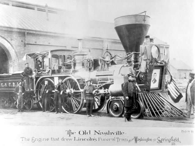
150 years ago today, the funeral train carrying the body of assassinated President Lincoln rolled through New Brunswick where it was greeted by mourners before continuing on to Illinois by way of New York City. I can only imagine what if must have felt like; days before they were celebrating the end of what seemed to be the most dreadful possible war, now they were shocked by the tragic assassination of the man many credited with ending the war.

Always the outlier, just months before New Jersey went to McLellan instead of Lincoln in the 1864 election. On April 24, I doubt there was any sign that New Brunswick remembered.


22 April 2015

Academic writing tips

Since some of our students are struggling with writing (we all are, right?), I thought this might be a great time to share this post from the London School of Economics on 30 tips for better academic writing.

Happy Earth Day

You could celebrate by looking through vast swaths of Landsat imagery on ArcGIS Online running on the Amazon Web Services Cloud.

20 April 2015

Sketch Out Loud at Rutgers Day

On Rutgers Day, Richard Alomar will be at the main entrance to Blake Hall on Red Oak Lane to talk about and lead the “Sketch Rutgers” Sketch Walk. The walks are scheduled to be 30 to 45 minutes long and start at 10:00 and 2:00.

Each person will receive a sketch pad and pencil. Participants are welcome to sketch all through the day. There will be short breaks to discuss and collect impressions on the walk. (http://sketchoutloud.blogspot.com/)


ED in AC

The Piano Man of Atlantic City made a lot of news regarding his eminent domain case. We'll talk a little more about the Supreme Court's perspective today in class.

19 April 2015

Digital archives

Keeping old data and programs is a challenging problem that many in GIS are just beginning to face. But at MoMA, they've developed a complex system to keeping old digital art. Their digital archivist has written a little about how they make sure that they have the proper software to go with the art (video, image, whatever).

So that it all still makes sens in 100 years they use the same thing as in GIS: metadata. But, instead of calling it that, they call it the archival information package. And, when their system is fully up and running, it willl not just be a stack of old floppies:
As MoMA acquires more digital artworks, and as the image resolutions used by artists and filmmakers increase, we project the digital collection to grow to approximately 1.2 petabytes (1.2 million gigabytes) by 2025.
 The new system will be dynamic and there is a video from IBM to show you how it works. But the overall story is one that should be fascinating to GIS thinkers who are looking forward to looking back someday.

17 April 2015

Gaudi in NYC

There is an exciting exhibit in NYC right now on Gaudi's work at Sagrada Familia. If you can't join our studio abroad, which will visit the cathedral, you can visit this exhibit for the next best thing. Make your trip to Harlem pretty soon, the exhibit ends May 8th.


16 April 2015

Stake in the Sand

Shortly before the Supreme Court issued its decision in Stop the Beach Renourishment v. Florida DEP, the NYTimes Sunday Magazine sent Andrew Rice down to Destin to talk to some of the impacted residents. Stake in the Sand is his look at the conflict without the knowledge of the resolution.

Cool map from Wisconsin

The WEDC has a map to help Wisconsin businesses tap into faster Internet connections.  Pretty cool use of mapping technology to promote technology. Will local planners see a difference in local businesses in 5 years? Hard to say. But this certainly represents a new realm of possibility.

It reveals patterns, not just points:
"When you look at southeast Wisconsin (on the map) you see a pretty big gaping hole," WEDC spokesman Mark Maley said.
Is this inverse e-Government?

Old fair, new park

Gustafson Guthrie Nichol's plans to turn San Antonio's old Hemisfair site into a new civic park are getting lots of attention. It is an important site (I have some fond memories of the place, years after the grand Exhibition). And it has great potential to expand the city's liveliest district as you can see in this plan:


Work!

"Indeed, the most somber speculation I can make about A.D. 2014 is that in a society of enforced leisure, the most glorious single word in the vocabulary will have become work!"

15 April 2015

Policy to watch

Will Rogers of the Trust for Public Land recently published an Op-Ed piece for the NY Times that provided a serious update about the current state of public land in the US. In response, the head of the Appalachian Mountain Club wrote a letter to the editor emphasizing that this is not a slow-motion process, but a timely conversation:
One of these battles is this year’s reauthorization of the Land and Water Conservation Fund, well known for protecting iconic natural treasures like the Appalachian Trail, but perhaps lesser known for its everyday impact through close-to-home urban parks like Gateway National Recreation Area in Staten Island, Jamaica Bay and Sandy Hook, N.J.

10 April 2015

Summer internship

MAHWAH ENVIRONMENTAL VOLUNTEERS ORGANIZATION & NEW YORK-NEW JERSEY TRAIL CONFERENCE COLLECTIVE INTERNSHIP RAMAPOUGH EARTH CREW SUMMER of 2015

What are you doing this summer? Do you like to help people and the environment, would you like to... -Build Trails -Design and Build a Farm -Empower Local Communities -Inspire Cultural and Political Change -Clean up Local Forests -Or Organize Volunteer Events In correlation with the New York New Jersey Trail Conference, MEVO a non-profit organization in Bergen County New Jersey is running two internship programs this summer.

The first, “Earth Crew” will work side by side with the New York-New Jersey Trail Conference to build trails, and restore forest ecology. On top of this the Earth Crew will be planning large-scale volunteer events, attending town meetings to pull for environmental justice, installing compost and recycling systems around local communities, and more. While Earth Crew is working on preserving and stewarding our local forest lands and communities, “Farm Crew” will be working with 2 acres of land in the Campgaw Mountain preserve designing and building a farm! You will work closely with professionals and young empowered youth to create a food producing farm that will feed our local communities. All at the same time you will be harvesting honey from our bee hives and teaching youth on the importance of organic food production and local farms.

Sound Interesting? Contact Ryan Martens at 201-414-4079, or ryan.martens@rutgers.edu for more information.

09 April 2015

Common Census Map Project

As a final follow-up to an earlier class conversation about social inventory data that includes opinions, I wanted to provide a link to the Common Census Map Project which offers a spatial representation of where people think their connection with their community ends. It also has neighborhoods in Manhattan and sports allegiance.

The neighborhood mapping has impressive potential for planning in areas where boundaries aren't clear. It certainly lets the Internet-accessing public send a clear message about their sense of identity and place.

08 April 2015

Late night reading

It is one thing to read about the 1909 Plan of Chicago it is another thing to read the actual plan. It is a fun distraction and an amazing look back at a document that transformed the city. The graphics in this digital version are impressive, too.


Earth Observation Day

Happy Earth Observation Day! Lose yourself in some imagery: https://eros.usgs.gov/satellite-imagery (Unless you are studying)

Tactile spatial experiences with augmented reality

It starts as a learning opportunity for kids


It can include simulation of water flowing


Adding some fire modelling makes it an easy to deploy emergency management tool


07 April 2015

MLUL

You don't need to read the whole thing, but this might be an interesting time to spend a few minutes browsing the Municipal Land Use Law of New Jersey. 

Remotely sensed changes

It is fun to watch the popular press discover the technologies that are integral to our every day work at the Center for Remote Sensing and Spatial Analysis. Today Vox has posted a piece by a fairly spatial reporter, Brad Plumer, that shows 15 pairs of satellite images highlighting some amazing examples of landscape change. They would be more fun if the subject matter weren't so serious (e.g., the disappearance of the Aral Sea).

This is pretty much the intersection of geomatics and planning at Rutgers. And if that interests you, I highly recommend the Fall 2015 class, 11:216:371 Introductory Remote Sensing and Image Analysis (formerly known as Air Photo).

Endangered Places

Visit The National Trust for Historic Preservation to see their list of the 11 Most Endangered Places for 2014. The 2015 list should be out soon, so watch for that too.

06 April 2015

Surburban mass transit

Communities are trying to adjust to match the expectations and demands of Millennials.Suburban communities are finding themselves at a particular disadvantage, having designed themselves in ways that make retrofitting most difficult. Millennials who want to ditch their cars are particularly hard to lure to these communities.

The Washington Post looks at an important piece of this puzzle, transit for suburban communities. The Post says that companies are insisting on building near transit because they can't get the best young employees without it.
 Why?
“Millennials are the gold standard of demographics today,” said Tom Clark, chief executive of the Metro Denver Economic Development Corp. “You chase them, and you entice them. They’re the most highly educated demographic the United States has ever had. . . . If you can get millennials to come to you, your long-term economic survivability is extraordinary.”

Demographics, transit, and retrofitting. 

Urban policies in NJ

In collaboration with NJ Spotlight, NextCity takes a fairly detailed look at New Jersey's urban policies.