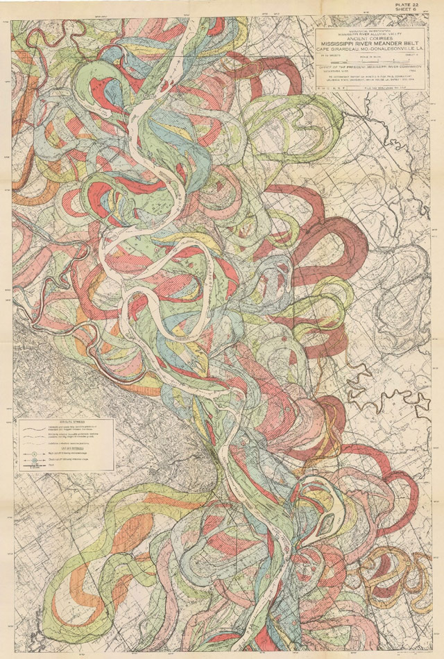
The Mississippi River used to change its course with remarkable regularity. Captured by the Corps of Engineers in the map above (one of Bill Rankin's 5 favorite maps) the dynamic river was important to the renourishment of the wetlands of Southern Louisiana.
It has changed so much that Brett Anderson writes in The Medium that logos using the state outline need to be changed if they are to be honest. (Lagniappe: The article includes a trip to Esri)


No comments:
Post a Comment